Short answer
- GPS was invented in 1973. That is the year the United States Department of Defense brought rival military satellite navigation programs together into one design, the system later called NAVSTAR GPS. The Smithsonian National Air and Space Museum summarizes it this way: at a meeting over Labor Day weekend in 1973, defense planners created the Defense Navigation Satellite System, later renamed the NAVSTAR Global Positioning System, now generally known as GPS. A history preserved in the GPS.gov archive gives the formal approval date as December 14, 1973, when the NAVSTAR GPS concept was approved with a planned constellation of 24 satellites in orbits of about 12 hours. That 1973 date marks the invention of the unified GPS design, not the launch of the first GPS satellite and not the day the system became fully usable. The first satellite built for the new design, the developmental Block I satellite often called Navstar 1, launched on February 22, 1978. An earlier experimental satellite, NTS-2, launched on June 23, 1977 and tested GPS signals and atomic clocks, but it belonged to the Navy test program that fed into GPS rather than to the Block I series. The constellation reached initial operational capability on December 8, 1993, when 24 satellites were operating in their assigned orbits, and full operational capability on April 27, 1995, when the United States Air Force Space Command declared that the system met all requirements with 24 operational Block II and Block IIA satellites in place. In short: designed and approved in 1973, tested in space in 1977 and 1978, limited service from the late 1970s, and fully operational in 1995. GPS was a United States military project at first, created by the Department of Defense and run through a Joint Program Office under the Air Force. No single person invented it alone. The names most often attached to it are Roger Easton of the Naval Research Laboratory, Ivan Getting of The Aerospace Corporation, and Bradford Parkinson, the first GPS program manager and chief architect of the NAVSTAR design. Gladys West, a mathematician at the Naval Surface Warfare Center, did Earth shape modeling work that helped make satellite positioning precise enough to work.
Introduction
Ask when GPS was invented and you will get a year, 1973, that sounds simple and settled. It is the right year for the most useful answer, but it is not the whole story. GPS was not switched on in a single day, and it was not the work of one inventor working alone. It grew out of earlier satellite navigation programs, was shaped into a single design over one long weekend in 1973, was approved later that year, was tested through the late 1970s and 1980s, and did not reach full operational capability until 1995. Civilian users then waited again, until a deliberate accuracy limit was switched off in 2000, before everyday GPS worked at the accuracy we now take for granted.
How GPS Works, in Plain Terms
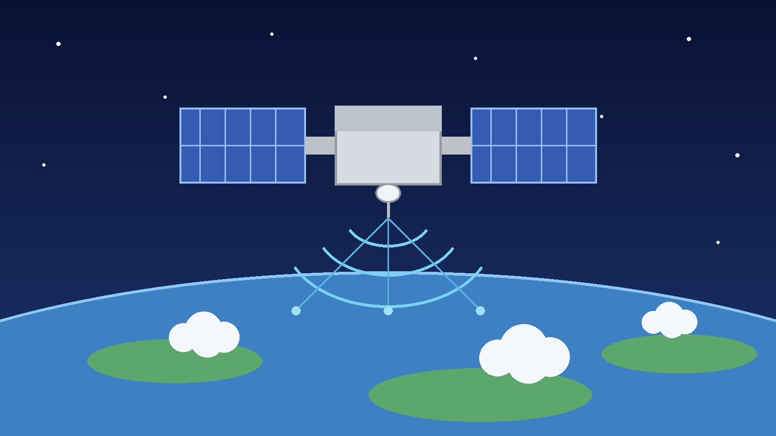
GPS works by timing. Each GPS satellite carries very accurate atomic clocks and broadcasts radio signals that say, in effect, where the satellite was and exactly when the signal left it. A receiver on the ground, in a car, on a ship, or in a phone, listens for those signals and measures how long each one took to arrive. Because radio signals travel at the speed of light, that travel time tells the receiver how far away each satellite was when it sent the signal. With distances to four satellites, the receiver can work out its position in three dimensions, latitude, longitude, and altitude, plus the correction needed for its own less accurate clock. That is why GPS gives both position and time.
Four satellites are the minimum for a full three dimensional fix with a clock correction. Three distances alone narrow a position to two possible points, and the fourth measurement resolves the ambiguity and fixes the receiver clock error. The satellites orbit at about 20,200 kilometers above Earth, roughly 12,600 miles, and complete an orbit in about 12 hours, so the pattern overhead changes through the day while global coverage remains continuous. The atomic clocks matter because tiny timing errors become large position errors: light travels about 300 meters in one microsecond, so a clock error of even a millionth of a second would put a user hundreds of meters from the true position. That is why Einstein’s theory of relativity also had to be taken into account, since clocks in orbit run at a slightly different rate from clocks on the ground. Measurements from NTS-2 confirmed the needed correction, and a relativistic offset remains built into GPS satellite clocks today.
The Spark: Sputnik in 1957
On October 4, 1957, the Soviet Union launched Sputnik 1, the first artificial Earth satellite. Scientists at the Johns Hopkins University Applied Physics Laboratory, William Guier and George Weiffenbach, tracked it by listening to its radio signal and noticed that the signal frequency shifted as the satellite approached and then moved away. That shift is the Doppler effect, the same effect that makes a passing siren change pitch. By measuring the shift carefully, they could work out the satellite orbit, and the reverse idea followed: if you know a satellite orbit precisely, and you measure the Doppler shift of its signal from the ground, you can work out where you are on Earth.
That reversal is the conceptual seed of satellite navigation. It did not yet give continuous, instant positioning, since it needed a satellite passing overhead at the right time, but it proved that a satellite signal could locate a receiver. Be precise, though: Sputnik did not invent GPS. What 1957 produced was proof that satellite tracking by radio could work, plus a political shock that pushed the United States to invest heavily in space technology.
The Programs That Came Before GPS
By the early 1970s, the United States military had not one satellite navigation effort but several, each solving part of the problem. Transit, also called the Navy Navigation Satellite System, was the first operational satellite navigation system. The Navy built it mainly to locate ballistic missile submarines, which needed to know their position accurately but could not surface to take a star sight in all conditions. Transit satellites flew in near polar orbits, and a submarine observed the Doppler shift in their signals to fix its position, typically within minutes. NASA summarizes the early approach as six satellites orbiting the poles, with submarines observing Doppler changes to pinpoint location within minutes. Transit worked, but it was slow and intermittent, and the fix was two dimensional, not the continuous three dimensional positioning the military wanted for fast moving aircraft and ground forces.
TIMATION, short for time navigation, was the Navy program led by Roger Easton at the Naval Research Laboratory. Easton proposed putting very accurate clocks in satellites, broadcasting precisely timed signals, and letting a receiver measure signal travel time to work out distance. The Laboratory states that Easton conceived the idea of using satellite carried precise atomic clocks for passive ranging, starting in 1964, and that accurate, reliable, and instantaneous satellite navigation could be achieved with passive ranging, circular orbits, and a constellation of space borne high precision clocks synchronized to a master clock. Those are, in plain terms, the primary features of modern GPS. TIMATION satellites flew in 1967 and 1969, followed by Navigation Technology Satellites NTS-1 in 1974 and NTS-2 in 1977, which flew the first cesium atomic frequency standard in the GPS 12 hour orbit and transmitted GPS signals.
Project 621B was the Air Force counterpart. It explored a system that broadcast ranging signals continuously so that fast moving users, especially aircraft, could get instant position fixes. A passive system, one in which the user only listens, was a major advantage: it can serve an unlimited number of receivers without revealing where they are. The Army contributed SECOR, Sequential Collation of Ranges, which tested ranging to satellites from the ground for survey work, and the Smithsonian lists it among the parallel efforts combined in 1973. Together, these programs had proved the pieces. What they had not produced was one system that combined them all, with global, continuous, three dimensional coverage.
Labor Day Weekend 1973: The Meeting That Made GPS
In April 1973, the Department of Defense directed that competing navigation concepts be consolidated into a single military system, and Colonel Bradford Parkinson was named director of the new Joint Program Office. An initial review of the Air Force 621B design in August 1973 was denied approval, in the GPS.gov archive account, for lack of consensus on an alternative concept. Parkinson then called a meeting at the Pentagon over Labor Day weekend, September 1 to 3, 1973, later nicknamed the Lonely Halls meeting because the building was largely empty for the holiday. About a dozen attendees, mostly Air Force officers plus Aerospace Corporation engineers, reshaped the 621B proposal into a seven page decision coordinating paper that set out the new system: passive ranging to four or more satellites, atomic clocks in space, and a constellation that could give continuous global coverage. The Smithsonian puts it simply: at that meeting, planners created the Defense Navigation Satellite System, later renamed NAVSTAR GPS.
Formal approval followed on December 14, 1973. The approved concept called for 24 satellites in inclined orbits of about 12 hours, which the GPS.gov archive presentation records as 717.973 minutes. That December approval is why some histories give December 1973, rather than September 1973, as the birth of the program: September was the design synthesis, December was the formal program approval.
Who Invented GPS? The Team Answer
There is no single inventor of GPS, and any article that names only one person is simplifying to the point of error. Roger Easton, a physicist at the Naval Research Laboratory, led the timing idea. The Laboratory records that Easton tested his TIMATION concept through four experimental satellites, TIMATION I and II in 1967 and 1969 and NTS-1 and NTS-2 in 1974 and 1977, and that his patent for a navigation system using satellites and passive ranging techniques was assigned United States Patent 3,789,409 on January 29, 1974. In 2005 he received the National Medal of Technology for, among other work, the invention of that navigation system and the development of TIMATION and the Navigation Technology Satellites that formed the technological basis for modern GPS. He is sometimes called a father of GPS, and the National Inventors Hall of Fame inducted him for TIMATION work that led to critical enabling technologies of NAVSTAR GPS. That honor is real, but it honors the timing and ranging foundation, not sole authorship of the whole system.
Ivan Getting, founding president of The Aerospace Corporation, championed the system concept for moving users and helped carry it through the political and technical arguments inside the Defense Department. Bradford Parkinson, then a colonel in the Air Force, was the first director of the Joint Program Office and the chief architect of the NAVSTAR design. The United States Space Force history states that in 1973 the NAVSTAR GPS Joint Program Office, headed by then Colonel Bradford Parkinson, developed the GPS architecture and initiated efforts to field a prototype system. Parkinson is also often called the father of GPS, which shows how loose that title is, since it has been applied to more than one person for different reasons. Gladys West worked at the Naval Surface Warfare Center at Dahlgren, Virginia, on mathematical modeling of Earth shape and on satellite data processing that fed into precise orbit determination. GPS needs an accurate Earth shape model because satellite positions are calculated relative to it. West was one of several mathematicians whose modeling made the system precise enough to be useful, not the sole inventor. James Spilker worked on signal design, Hugo Fruehauf worked on atomic clocks, and many engineers at Rockwell International, IBM Federal Systems, and other contractors built the satellites, ground stations, and receivers.
NAVSTAR itself needs a note. Many histories expand it as Navigation System with Timing and Ranging, and NASA uses that expansion for the first NAVSTAR satellite launched in 1978. Other program histories state that NAVSTAR was chosen as a name in its own right and was not originally an acronym for that phrase. This guide uses the expansion because readers will meet it everywhere, but flags the dispute.
Building and Testing: 1977 to 1989
NTS-2 launched on June 23, 1977, from Vandenberg Air Force Base in California, as the Navy Navigation Technology Satellite that first flew in the GPS 12 hour orbit and transmitted GPS signals, carrying cesium atomic clocks. The Naval Research Laboratory notes that using time measurements from NTS-2, Easton experimentally verified Einstein’s theory of relativity, and that the relativistic offset correction he applied is still in use by every satellite in the GPS constellation. A Rockwell Collins receiver team in Cedar Rapids, Iowa, received and decoded the first GPS signal from NTS-2 on July 19, 1977, according to contemporary company histories. That July night is not the invention date of the system.
The first Block I developmental satellite launched on February 22, 1978. Ten Block I prototype satellites were launched between 1978 and 1985, with one additional unit lost in a launch failure, in the widely repeated program count. With four Block I satellites in view, a full four-dimensional fix became possible intermittently, and GPS started to provide positioning, navigation, and timing services to military and civilian users on a limited but worldwide basis. Limited is the key word: with only a few satellites, coverage was intermittent, and a user could get a fix only when enough satellites were overhead. The first operational Block II satellite launched on February 14, 1989, starting the second stage of the system. Block II and Block IIA satellites filled out the constellation through the early 1990s, and by the Gulf War in 1991, GPS was already proving its military value in desert operations, even before full operational capability was declared.
Fully Operational: 1993 and 1995
Two capability dates cause the most confusion in GPS histories, so keep them apart. Initial operational capability was declared on December 8, 1993, when Air Force Space Command found that 24 Block I and Block II and Block IIA satellites were operating in their orbits and providing the Standard Positioning Service to civilian users and the Precise Positioning Service to authorized military users. In plain terms, the constellation was complete enough to promise the standard service worldwide, even though testing and replacement launches continued.
Full operational capability was declared on April 27, 1995. That declaration signified the system met all requirements with 24 operational Block II and Block IIA satellites in their assigned orbital slots, providing both the military Precise Positioning Service and the civil Standard Positioning Service. The difference is not the number 24, which appears in both, but the test and requirement status: initial capability meant the service was available, full capability meant it had passed its full requirement checks with the operational satellite type in place. NASA’s short history says the 24 satellite system became fully operational in 1993. That is best read as loose wording for the 1993 constellation completion, versus the formal full capability declaration in 1995, which is the date this guide follows. The GPS.gov archive presentation also records December 1993 for initial operational capability, matching the Space Force date.
The Civilian Opening: 1983, Handheld Receivers, and 2000
GPS was designed as a military system, but a civilian signal was part of the design from early on. The Standard Positioning Service, using the coarse acquisition code on the L1 frequency, was available to civilian users, while the Precise Positioning Service, using the protected code on L1 and L2, was restricted to authorized military users. That dual structure is why the civilian story has two separate dates: a policy opening in 1983, and a practical accuracy opening in 2000.
On September 1, 1983, Korean Air Lines Flight 007, a Boeing 747 flying from New York to Seoul via Anchorage, was shot down by a Soviet interceptor after straying into Soviet airspace, killing all 269 people aboard. On September 16, 1983, the Reagan administration announced that GPS would be made available for civilian use, free of charge, once the system was completed, in order to improve aviation safety and prevent similar navigation errors. Careful histories note a correction to the popular version: the announcement was read by White House Press Secretary Larry Speakes, not delivered by President Reagan himself in a speech mentioning GPS, and civilian signals were already being broadcast by the satellites then in orbit. The policy point still stands, but the story is not accurately told as Reagan personally declassifying a secret system in a single order.
The first commercial handheld GPS receiver reached the market before the constellation was complete. The Smithsonian National Museum of American History describes the Magellan NAV 1000 as the first handheld receiver introduced to the consumer market. Magellan’s anniversary account says it was publicly introduced at trade shows in 1988 and entered the market in May 1989, measured 8.75 inches by 3.5 inches by 2.25 inches, weighed 1.5 pounds, ran on six AA batteries, and sold for approximately 3,000 dollars. It took about four minutes to compute latitude and longitude, and because coverage was still partial, it included a satellite schedule function so users knew when a fix would be possible.
Selective Availability was the deliberate degradation of the civilian signal, limiting civilian horizontal accuracy to about 100 meters while military users kept far better accuracy. On May 1, 2000, President Bill Clinton announced that the United States would stop the intentional degradation of GPS signals available to the public beginning at midnight that night. His statement said civilian users would be able to pinpoint locations up to ten times more accurately than before, and that the United States would continue to provide GPS capabilities worldwide free of charge, while retaining the ability to deny GPS signals regionally if national security required it. May 1, 2000 is therefore the date when civilian GPS became practically precise for everyday use, even though the system had been invented in 1973 and fully operational since 1995.
GPS Timeline at a Glance
| Date | Milestone | Why it matters | | October 4, 1957 | Sputnik 1 launches | Doppler tracking proves satellite signals can locate objects | | 1964 | Transit enters Naval service | First satellite navigation system in service, mainly for submarines | | 1964 to 1977 | TIMATION and test satellites | Satellite atomic clocks and passive ranging proved | | September 1 to 3, 1973 | Lonely Halls meeting | Rival programs merged into one system design | | December 14, 1973 | NAVSTAR GPS approved | Official program birth, 24 satellites planned | | June 23, 1977 | NTS-2 launches | First GPS signals and cesium clocks in GPS orbit | | February 22, 1978 | First Block I satellite launches | Developmental constellation begins | | September 16, 1983 | Civilian use announced | Policy opening after Korean Air Lines Flight 007 | | February 14, 1989 | First Block II satellite launches | Operational constellation build out begins | | May 1989 | Magellan NAV 1000 on sale | First commercial handheld receiver, about 3,000 dollars | | December 8, 1993 | Initial operational capability | 24 satellites providing standard and precise services | | April 27, 1995 | Full operational capability | System meets all requirements with operational satellites | | May 1, 2000 | Selective Availability ends | Civilian accuracy improves about tenfold overnight |
Where Sources Disagree
Four disagreements appear regularly. First, the invention year is sometimes given as 1974, from the patent date, or 1978, from the first Block I launch. Those mark later steps, not the program creation, which the Smithsonian, the GPS.gov archive, and the Space Force history all place in 1973. One detailed program history gives December 17, 1973 for the DSARC approval; this guide follows the GPS.gov archive presentation date of December 14, 1973 for the DSARC 1 meeting. Second, NAVSTAR is sometimes presented as a firm acronym and sometimes as a chosen name, as flagged above. Third, full operation is dated to 1993 in some short histories and to 1995 in formal program histories; 1993 is the initial capability date, April 27, 1995 is the formal full capability declaration. Fourth, the 1983 civilian opening is often told as a presidential declassification that made GPS instantly public, when the record shows an administration announcement, read by the press secretary, promising civilian availability once the system was completed.
GPS did not arrive as a consumer product. For most of the 1980s it was a military test system with a partial constellation, expensive receivers, and intermittent coverage, and even after 1995 civilian accuracy was limited until 2000. Phone GPS depends on later developments, cheaper receivers, mapping software, and assistance data, and this guide does not credit 1973 with inventing phone navigation. Other countries later built their own systems, including Russia GLONASS, the European Union Galileo system, and China BeiDou system, which are separate systems, not versions of GPS. GPS III satellites modernize the 1973 system rather than reinventing it, and GPS signals remain weak on arrival and liable to blocking or jamming, which is why critical users still use other methods alongside GPS.
Why did it take 22 years from design to full operation? Each satellite needed space hardened atomic clocks that could survive launch and years in orbit without servicing, receivers needed to acquire faint signals and correct for ionosphere delay, and ground stations needed to track satellites and upload corrections. Launches slipped, budgets were cut and restored, the planned constellation was reduced and then restored to 24 satellites, and the Challenger disaster in 1986 forced a change of launch vehicle. Transit could locate a slow moving submarine a few times a day. GPS had to locate fast moving aircraft continuously, anywhere on Earth, in three dimensions, to meters, without the user transmitting anything.
Frequently Asked Questions
When was GPS invented?
In 1973, when the Department of Defense merged earlier Navy, Air Force, and Army work into one system, later called NAVSTAR GPS. The design was shaped in September 1973 and formally approved on December 14, 1973. Full operational capability followed in 1995.
Who invented GPS?
No one person alone. Roger Easton led the Navy TIMATION timing work, Ivan Getting championed the positioning concept, Bradford Parkinson was the first program manager and chief architect, and Gladys West contributed Earth shape modeling. Many other engineers and contractors built the system.
What does GPS stand for?
Global Positioning System. Its early program name was NAVSTAR GPS, commonly expanded as Navigation System with Timing and Ranging, although some program accounts say NAVSTAR was chosen as a name rather than created as a strict acronym.
When did GPS become available to civilians?
The administration announced on September 16, 1983 that GPS would be made available for civilian use, free of charge, once completed. Civilian GPS became practically precise on May 1, 2000, when Selective Availability was discontinued.
When was the first GPS satellite launched?
NTS-2, the Navy test satellite that first transmitted GPS signals from the GPS orbit, launched on June 23, 1977. The first Block I developmental satellite launched on February 22, 1978, and the first operational Block II satellite on February 14, 1989.
When did GPS become fully operational?
Initial operational capability was declared on December 8, 1993, and full operational capability on April 27, 1995. Some short histories say 1993 for full operation, but the formal full capability declaration was in 1995.
Why was GPS invented?
To give United States military forces accurate, continuous, worldwide positioning, navigation, and timing. Earlier systems such as Transit located submarines intermittently, but the military wanted a system that could locate ships, aircraft, and ground forces quickly, in three dimensions, anywhere, without the user transmitting.
Was GPS invented for phones?
No. GPS was invented as a military system in 1973, long before phones with GPS receivers existed. The first commercial handheld receiver, the Magellan NAV 1000, reached retailers in May 1989 at about 3,000 dollars. GPS in phones came much later.
How is GPS different from GLONASS and Galileo?
GPS is the United States system, invented in 1973 and fully operational in 1995. GLONASS is the Russian system and Galileo is the European Union system. They provide similar services with their own satellites, and many receivers can use more than one system at once.
Sources & references
- Smithsonian National Air and Space Museum, Time and Navigation, GPS Begins: Joint Program Office established in 1973, combination of Transit, TIMATION, 621B, and SECOR, Defense Navigation Satellite System created at the Labor Day weekend 1973 meeting and later renamed NAVSTAR Global Positioning System.
- GPS.gov archive, Edward H. Martin, Global Positioning System workshop presentation, March 17, 2011: April 1973 consolidation directive and Parkinson named Joint Program Office director, September 1973 Labor Day weekend Pentagon meeting and seven page decision paper, December 14, 1973 NAVSTAR GPS concept approval with 24 satellites in about 12 hour orbits, December 1993 initial operational capability.
- United States Space Force, Los Angeles Air Force Base, 20th Anniversary of Initial Operational Capability of the GPS Constellation: 1973 Joint Program Office under Bradford Parkinson, prototype Block 0 satellite June 22, 1977, Block I from 1978, first Block II February 14, 1989, initial operational capability December 8, 1993 with 24 satellites, full operational capability April 27, 1995 with 24 Block II and Block IIA satellites.
- United States Naval Research Laboratory, Father of GPS and Pioneer of Satellite Telemetry and Timing Inducted into National Inventors Hall of Fame: Easton TIMATION concept from 1964, four experimental satellites TIMATION I and II in 1967 and 1969 and NTS-1 and NTS-2 in 1974 and 1977, NTS-2 first cesium standard in the GPS orbit and relativity verification, patent assigned January 29, 1974 as United States Patent 3,789,409, National Medal of Technology in 2005.
- NASA, Global Positioning System History, October 27, 2012: Sputnik era Doppler origin, Navy mid 1960s submarine experiments with six polar satellites, early 1970s Department of Defense decision, first NAVSTAR satellite in 1978, 24 satellite system described as fully operational in 1993 (wording qualified in the article against the formal 1995 declaration).
- The White House, Office of the Press Secretary, Statement by the President Regarding the United States Decision to Stop Degrading Global Positioning System Accuracy, May 1, 2000, Clinton White House archives: Selective Availability discontinued beginning at midnight May 1, 2000, civilian accuracy up to ten times better, free worldwide service continued, regional denial capability retained.
- Smithsonian National Museum of American History, Magellan Systems Corporation GPS Records and Magellan NAV 1000 object record: NAV 1000 as first handheld receiver introduced to the consumer market, size 8.75 inches by 3.5 inches by 2.25 inches, weight 1.5 pounds, sale price approximately 3,000 dollars, introduction at 1988 trade shows and market entry in May 1989 per Magellan anniversary account.


