Short answer
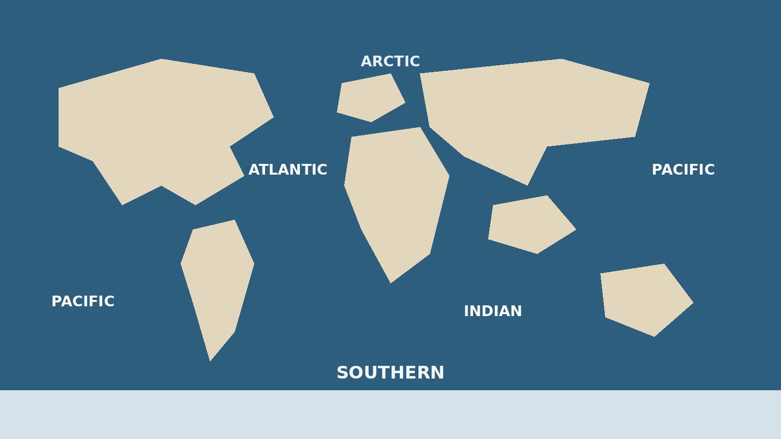
- There are five named oceans: Pacific, Atlantic, Indian, Southern, and Arctic, in that size order.
- The Pacific is by far the largest, at about 168.7 million square kilometers in NOAA data, more than all of Earth's land combined.
- The count was four for most of the 20th century. The Southern Ocean was dropped by the International Hydrographic Organization in 1953, and its return took decades.
- National Geographic formally recognized the Southern Ocean as the fifth ocean on June 8, 2021. That was National Geographic's decision as a mapmaker, following earlier moves by the U.S. Board on Geographic Names (1999) and NOAA (2021).
- Physically, there is one world ocean: all five are connected, and water, heat, and marine life move between them. NOAA puts it this way: while there is only one global ocean, it is geographically divided into distinct named regions.
- A sea is smaller than an ocean and usually partly enclosed by land. Seas sit inside oceans, not alongside them.
Ask a room of adults how many oceans there are and you will hear four, five, and occasionally one. Each answer has a real basis. The modern standard answer is five named oceans: the Pacific, Atlantic, Indian, Southern, and Arctic. Older teaching said four, because the waters around Antarctica were long treated as the southern ends of three other oceans. And physically, all five are one connected world ocean. This article explains each answer, ranks the five oceans by size, tells the story of the Southern Ocean, and clears up how seas differ from oceans.
The Five Oceans Ranked by Size
Ocean boundaries are conventions, so published areas differ slightly between atlases, mainly over where one ocean ends and another begins and whether every marginal sea is counted. The table below uses the dataset compiled by NOAA’s National Centers for Environmental Information (Eakins and Sharman, 2010), which treats the Southern Ocean as the waters south of 60 degrees south latitude.
| Rank | Ocean | Surface area (million sq km) | Share of the world ocean | Average depth (m) |
|---|---|---|---|---|
| 1 | Pacific | 168.7 | 46.6% | 3,970 |
| 2 | Atlantic | 85.1 | 23.5% | 3,646 |
| 3 | Indian | 70.6 | 19.5% | 3,741 |
| 4 | Southern | 22.0 | 6.1% | 3,270 |
| 5 | Arctic | 15.6 | 4.3% | 1,205 |
| World ocean | 361.9 | 100% | 3,688 |
Two things stand out. First, the scale gap at the top: the Pacific alone holds about half the ocean’s surface and is larger than the Atlantic and Indian combined. Second, the Arctic is the outlier at the bottom: smallest, and by average depth barely a third as deep as the others, because so much of it is shallow continental shelf.
Together the five oceans cover about 71 percent of Earth’s surface and hold about 97 percent of all the water on the planet. Everything else (rivers, lakes, groundwater, ice, and the water in living things and the air) shares the remaining few percent.
Why Some Sources Say Four
If you learned four oceans, you were not taught wrong. You were taught the mid-20th-century map.
For most of modern history, the named oceans were the Pacific, Atlantic, Indian, and Arctic, each fenced in by continents. The cold waters ringing Antarctica were assigned to whichever of the three big oceans lay to their north, so the Pacific, Atlantic, and Indian were drawn as extending all the way to the Antarctic coast.
The alternative view is old, not new. Mariners had a name for the southern waters for centuries, and the International Hydrographic Organization (IHO), the intergovernmental body that standardizes the names and limits of oceans and seas, included a Southern Ocean in the 1937 edition of its Limits of Oceans and Seas. The dispute was never really about whether the water was distinctive. It was about where to draw a northern boundary in open water with no coastline to follow, a line that also shifts with the seasons as currents and fronts move.
Some sources still say four, for defensible reasons: their publisher follows the IHO’s last formally adopted limits, which remain the 1953 edition, and that edition has no Southern Ocean. Others treat the Arctic as a marginal sea of the Atlantic rather than a full ocean, which can even produce a count of three big oceans plus subdivisions in older oceanography texts. The honest summary is that five is now the mainstream answer, four is the older convention, and neither reflects a discovery of new water.
One Ocean: The World Ocean Idea
The third answer, one, is the physical description underneath the naming debate.
There are no walls between the oceans. A molecule of water in the Pacific can, over time, travel into the Indian Ocean around Australia, into the Atlantic around South Africa, and north toward the Arctic, carried by the global pattern of currents sometimes called the conveyor belt. Heat, salt, nutrients, larvae, and pollutants make the same journeys. The Southern Ocean’s great current links the three big basins directly, flowing around Antarctica without meeting land.
That is why NOAA, the U.S. National Oceanic and Atmospheric Administration, describes the geography in two layers at once: there is only one global ocean, geographically divided into distinct named regions whose boundaries have evolved for historical, cultural, geographical, and scientific reasons. The names are tools for talking about places. The water itself is a single system.
The Southern Ocean: The Full Story
The Southern Ocean is the only ocean defined by a current rather than by the continents around it, and its official history is a century-long loop.
1937: recognized. The IHO’s second edition of Limits of Oceans and Seas (1937) included an ocean around Antarctica, with northern limits drawn partway toward the neighboring continents.
1953: removed. In the third edition (1953), the IHO dropped it. In the IHO’s later retelling, most member-state opinion saw no justification for separating these waters from the southern parts of the Atlantic, Indian, and Pacific, and the northern limits were difficult to fix because they change seasonally.
2000: proposed again, never ratified. The IHO revisited the question in a 2000 survey of its 68 member states. Twenty-eight replied, and every respondent except Argentina agreed to define a new ocean. The name “Southern Ocean” beat “Antarctic Ocean,” and half the respondents backed a northern limit at 60 degrees south. A draft fourth edition of the Limits followed in 2002, but amid unrelated disputes over other sea names and limits, it was never ratified or published. That remains the formal position today: the 1953 edition is still the IHO’s operative standard, while the unratified draft’s Southern Ocean is widely used in practice.
1999 and 2021: the United States moves. The U.S. Board on Geographic Names approved the name Southern Ocean in 1999, and in February 2021 NOAA officially recognized the Southern Ocean as distinct.
June 8, 2021: National Geographic recognizes it. On World Oceans Day, the National Geographic Society announced that it would recognize the Southern Ocean as the world’s fifth ocean on its maps and atlases, which it has published since 1915. Attribution matters here: this was the decision of one influential mapmaker, not a ruling by science as a whole or by the IHO. National Geographic Society geographer Alex Tait explained the reasoning plainly: scientists had long recognized that the waters around Antarctica form a distinct ecological region defined by currents and temperatures, but with no international agreement, the Society had never officially recognized it, and it decided the time had come. The Society also hoped the label would support conservation, since naming the region in classrooms and atlases draws attention to it.
So why does this ring of water deserve to be an ocean at all? Because it behaves like a separate system. The Antarctic Circumpolar Current, the largest current on Earth, sweeps eastward around the continent, driven by powerful westerly winds and unbroken by any landmass. National Geographic dates the current’s formation to about 34 million years ago, when Antarctica separated from South America and the gateway between them opened. The current, and the Antarctic Convergence where cold Antarctic water meets warmer water to the north, keep the Southern Ocean colder and somewhat less salty than the oceans above it, and wall Antarctica off from warmer water. It is the only ocean that completely embraces a continent instead of being embraced by one, and the only one touching three others. Its northern boundary is conventionally set at 60 degrees south latitude, a line with no land interruptions, roughly tracking the current’s edge.
Meet the Five Oceans
Pacific: the largest and deepest
The Pacific covers about a third of Earth’s entire surface, more area than all the continents combined. It stretches from the Arctic to the Southern Ocean and is bordered by Asia and Australia to the west and the Americas to the east. It is also the deepest ocean on average, and it holds the deepest point known on the planet, the Challenger Deep in the Mariana Trench, around 10,900 to 11,000 meters down (survey figures vary slightly by method). Ferdinand Magellan named it Mar Pacífico, “peaceful sea,” in 1520, for the calm weather his fleet met after rounding South America; the name stuck even though the Pacific’s Ring of Fire rim produces most of the world’s major earthquakes and volcanic eruptions.
Atlantic: the S-shaped second
The Atlantic separates the Americas from Europe and Africa in a long S curve. It is the second-largest ocean and the most indented by marginal seas (the Mediterranean, Caribbean, Baltic, and North Seas among them), which is why its total area jumps the most when adjacent seas are included. Down its middle runs the Mid-Atlantic Ridge, an underwater mountain chain where new seafloor forms. The Gulf Stream carries warm water from the tropics past the U.S. East Coast toward northern Europe, moderating the climate of the lands it passes. The Atlantic’s deepest point is the Milwaukee Deep in the Puerto Rico Trench, about 8,380 meters.
Indian: the enclosed third
The Indian Ocean is the third largest, walled in by Africa to the west, Asia to the north, and Australia to the east. It is the only ocean named after a country, India. Unlike the Pacific and Atlantic, it has no temperate northern reach: land blocks it at the tropics, so it is largely a warm ocean, and its northern winds reverse with the monsoon seasons, a pattern sailors have used for trade routes for well over a thousand years. Much of the world’s oil shipping crosses it.
Southern: the current-defined fourth
The Southern Ocean surrounds Antarctica and is the second-smallest ocean, ahead of only the Arctic. It has no continental northern shore; its boundary is the 60th parallel and the moving front of the Antarctic Circumpolar Current. Its waters are cold, nutrient-rich, and famously rough. Upwelling around Antarctica feeds vast swarms of krill, which in turn feed whales, seals, penguins, and fish. It also contains the Ross Sea, home to what National Geographic describes as the world’s largest marine protected area.
Arctic: the smallest and shallowest
The Arctic Ocean sits around the North Pole, ringed almost completely by the northern coasts of North America, Europe, and Asia. It is the smallest ocean (about a tenth of the Pacific’s area) and the shallowest, since broad continental shelves underlie much of it. For much of the year a large part of its surface is frozen sea ice. Its near-enclosure by land, small size, and shallow depth are why some geographers have classed it as a sea of the Atlantic; in the five-ocean system it keeps ocean status.
Oceans and Seas: What Is the Difference?
People use “ocean” and “sea” interchangeably in everyday speech, but geographers draw a real distinction. NOAA’s version is the standard one: seas are smaller than oceans and are usually located where land and ocean meet; typically, seas are found on the margins of an ocean and are partially enclosed by land.
So a sea is a subdivision of an ocean, partly fenced by land, islands, or sometimes even currents. The Mediterranean Sea is part of the Atlantic Ocean system; the Bering Sea belongs to the Pacific; the Caribbean Sea to the Atlantic. Counting them depends on the definition used, but by the usual one there are roughly 50 seas in the world.
Three quirks confuse the picture. First, the Sargasso Sea in the North Atlantic is not enclosed by land at all; it is defined entirely by the ocean currents that circle it. Second, some landlocked salt lakes carry “sea” as a historical name, above all the Caspian Sea between Europe and Asia, which geographers generally regard as the world’s largest lake rather than a true sea; the shrinking Aral Sea and the Dead Sea are similar cases. Third, the old phrase “the seven seas” was never a literal count of seven bodies of water. It is an ancient expression for the known waters of the world, and different eras filled the list with different seas.
Size alone is not the rule, either. The Philippine Sea, generally ranked as the largest sea, covers an estimated 5 million square kilometers, yet it remains a sea because it is a marginal part of the Pacific, bounded by island arcs. An ocean, by contrast, is one of the great named divisions of the world ocean, defined by the basin it occupies.
Why the Answer Matters
The five-ocean count is more than a trivia fix. Names direct attention, teaching, and law. Students study the ocean by named regions, so leaving the Southern Ocean off the map long meant leaving its ecology off the syllabus, one of National Geographic’s stated reasons for acting. Conservation organizes itself by named places, too: the Ross Sea marine protected area exists partly because the region could be described and defended as a distinct place. Treating the Southern Ocean as a region with its own behavior, rather than the leftover edges of three other oceans, also matches how the physical system works.
Frequently Asked Questions
Is the Southern Ocean a real ocean?
Yes, in the practical sense used by most countries, scientists, and mapmakers today. Its water is set apart by the Antarctic Circumpolar Current and its own ecology. Its formal status is narrower: the IHO’s last ratified limits (1953) do not include it, and the 2002 draft that would restore it was never ratified, so a minority of references still fold it into the neighboring oceans.
Who decides how many oceans there are?
No single authority. The IHO standardizes ocean and sea names for its member states, but its process requires agreement the Southern Ocean has never fully achieved. In practice, national naming boards (such as the U.S. Board on Geographic Names), agencies like NOAA, and major mapmakers such as National Geographic each decide for their own maps, and the five-ocean model is now the common result.
Which ocean is the largest, and which is the smallest?
The Pacific is the largest by a wide margin: about 168.7 million square kilometers, roughly 46.6 percent of the world ocean. The Arctic is the smallest at about 15.6 million square kilometers, and also the shallowest.
Why do some atlases still show four oceans?
Because publishers follow different standards. An atlas that tracks the IHO’s ratified 1953 limits will show the Pacific, Atlantic, and Indian extending to Antarctica and will not label a Southern Ocean. Atlases also change slowly, since plates, globes, and textbooks are revised on long cycles.
Is the Caspian Sea an ocean or a sea?
Neither, strictly. Despite its name and salt water, the Caspian is an enclosed lake with no connection to the world ocean, commonly described as the largest lake on Earth. Its legal status has been argued over by the states around it precisely because “sea” and “lake” carry different legal consequences.
Conclusion
The complete answer has three layers. By the naming convention now used by most countries and mapmakers, there are five oceans: Pacific, Atlantic, Indian, Southern, and Arctic. By the older IHO convention still printed in some references, there are four. And physically, beneath every convention, there is one connected world ocean covering about 71 percent of the planet, divided by us into regions so we can study, navigate, and protect it. Five names, one ocean.
Keep reading: What Causes the Northern Lights? The Science of the Aurora Explained
Keep reading: How Many Bones Are in the Human Body?
Sources & references
- NOAA, National Ocean Service, Ocean Facts (oceanservice.noaa.gov): "How many oceans are there?" (one global ocean divided into named regions; boundaries evolved for historical, cultural, geographical, and scientific reasons) and "What's the difference between an ocean and a sea?" (seas are smaller, usually where land meets ocean, partially enclosed by land; Sargasso Sea exception).
- Eakins, B.W. and Sharman, G.F., Volumes of the World's Oceans from ETOPO1, NOAA National Centers for Environmental Information (formerly National Geophysical Data Center), 2010: surface areas, shares, and average depths for the five oceans and the world ocean, as tabulated by Encyclopaedia Britannica.
- International Hydrographic Organization (iho.int): Assembly proposal PRO-3.3 (2023), recounting the Southern Ocean's inclusion in the 1937 second edition of Limits of Oceans and Seas, its omission from the 1953 third edition, and subsequent deliberations; CIA World Factbook note on the IHO's year-2000 definition circulated as a 2002 draft and not formally adopted.
- National Geographic (nationalgeographic.com), "There's a New Ocean Now: Can You Name All 5?" (June 2021): National Geographic's recognition of the Southern Ocean effective June 8, 2021; Alex Tait on the distinct ecological region; U.S. Board on Geographic Names using the name since 1999; NOAA's official recognition in February 2021; Antarctic Circumpolar Current formed about 34 million years ago; Ross Sea marine protected area.