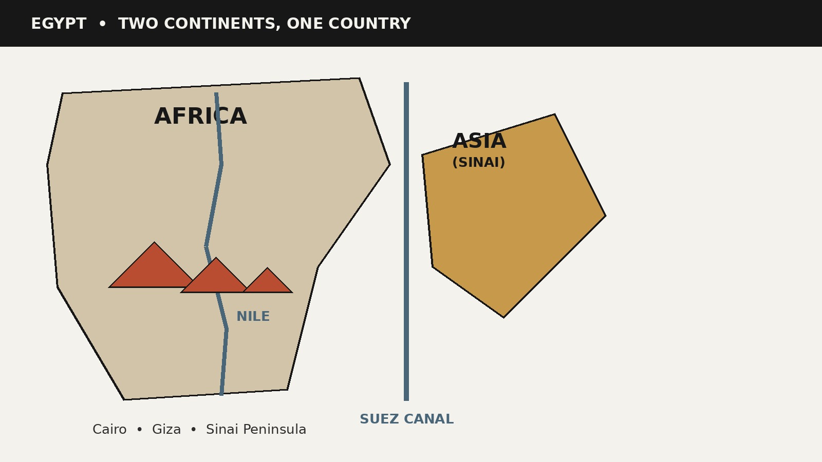
It sounds like a question with a one-word answer, and on most maps it is. Egypt sits in the northeastern corner of Africa, wrapped by the Mediterranean Sea to the north and the Sahara to the west and south. Yet the question keeps getting asked, on travel forums, in classrooms, and in search boxes, and there is a good reason for that: Egypt is one of the few countries in the world whose territory sits on two continents. The answer is yes, with a genuinely interesting footnote.
This article gives you the short answer, the full map, and the explanation of why the confusion exists in the first place. Every fact below is checked against primary sources: the CIA World Factbook, Encyclopaedia Britannica, and Egypt’s own State Information Service.
Where Egypt sits on the map
Start with the basics, because they settle the question immediately. Egypt’s official name is the Arab Republic of Egypt. The country’s geographic coordinates are 27 00 N, 30 00 E, and the CIA World Factbook places it in “Northern Africa, bordering the Mediterranean Sea, between Libya and the Gaza Strip, and the Red Sea north of Sudan.” Egypt’s own State Information Service describes the country as “located in the north-eastern corner of Africa and south-western Asia,” which is the first hint of the two-continent story.
Egypt covers about 1,001,450 square kilometers, according to the Factbook, making it slightly more than three times the size of New Mexico. (Britannica gives a closely similar figure of 996,603 square kilometers; the small difference comes from how each source measures inland water.) It shares 2,665 kilometers of land borders with four neighbors: Libya to the west (1,115 km), Sudan to the south (1,273 km), Israel to the northeast (266 km), and the Gaza Strip (11 km). Its coastline runs 2,450 kilometers along two seas, the Mediterranean in the north and the Red Sea in the east.
The population, estimated at about 109,139,000 in 2026 by Britannica, is concentrated in a remarkably small part of that vast area. Egypt’s State Information Service divides the country into four parts: the Nile Valley and Delta, the Western Desert, the Eastern Desert, and the Sinai Peninsula. The Nile Valley and Delta occupy only about 33,000 square kilometers, less than 4 percent of the country’s total area, yet they hold nearly all of Egypt’s people, farms, and cities. The Western Desert takes up about 671,000 square kilometers and the Eastern Desert about 225,000. Almost everything Egyptians do, from growing food to building cities, happens along the Nile.
The capital, Cairo, sits on the banks of the Nile in Lower Egypt, about 165 kilometers south of the Mediterranean coast and 120 kilometers west of the Suez Canal. The State Information Service calls Cairo the most populous city in Africa and the Arab world, with about 10 million residents in the city proper. The official language is Arabic and the currency is the Egyptian pound.
The twist: Egypt is a transcontinental country
Here is the footnote that makes the question worth asking. The CIA World Factbook’s location entry for Egypt ends with a phrase most country entries do not have: the country “includes the Asian Sinai Peninsula.” Britannica is even more direct, noting that the Sinai Peninsula is “usually regarded as being geographically part of Asia.”
So the full answer is: Egypt is an African country with a piece of Asia attached. Roughly 94 percent of Egypt’s land, including Cairo, the Nile Valley, the Delta, Alexandria, Luxor, Aswan, and the pyramids of Giza, sits in Africa. The remaining roughly 6 percent, the Sinai Peninsula, sits in Asia. The arithmetic is straightforward: the Sinai covers about 61,000 square kilometers, which is just over 6 percent of Egypt’s total area of about 1,001,450 square kilometers.
Being on the line between continents is not unusual in world geography. Russia, Turkey, and Kazakhstan all straddle Europe and Asia. Egypt does the same thing between Africa and Asia, and the CIA World Factbook calls the Sinai “the only land bridge between Africa and the remainder of the Eastern Hemisphere,” which is a striking way of saying that this one peninsula is where the two continents physically touch.
Where exactly Africa ends and Asia begins
If Egypt sits on two continents, where is the line? The answer is the Suez Canal, and Britannica states it plainly: “The canal separates Africa from Asia.” The canal is a sea-level waterway that runs north to south across the Isthmus of Suez, connecting the Mediterranean Sea to the Red Sea. It stretches 193 kilometers between Port Said in the north and the city of Suez in the south, and to the west of it lies the low-lying Nile Delta while to the east lies the Sinai Peninsula. The canal was completed in 1869, and it remains one of the world’s most heavily used shipping lanes.
The land the canal cuts through has its own name: the Isthmus of Suez, which Britannica calls “the sole land bridge between Africa and Asia.” Before the canal was dug, this narrow strip of land joined the two continents. After 1869, the waterway itself became the conventional boundary. This is a convention, not a law of nature. Continents do not have official borders the way countries do; geographers agree on where one ends and the other begins, and at this particular spot on the map, the agreement is that the Suez Canal is the line. The Gulf of Suez, which extends south from the canal toward the Red Sea, continues the same boundary.
That is why the answer to “is Egypt in Africa” depends on which part of Egypt you mean. Everything west of the canal is Africa. Everything east of it, the Sinai, is Asia. And because both sides belong to the same country, you can stand in Africa in Cairo in the morning and in Asia in the Sinai by the afternoon without ever crossing an international border.
Inside the Sinai: Egypt’s Asian side
The Sinai Peninsula is the reason this article exists, so it deserves a closer look. It is a triangular peninsula of about 61,000 square kilometers, roughly 210 kilometers from east to west and 385 kilometers from north to south, bounded by the Mediterranean Sea to the north, the Gulf of Suez and the Suez Canal to the west, the Gulf of Aqaba to the east, and the Red Sea to the south. Administratively, Egypt divides it into two governorates: North Sinai (Shamal Sina) in the north and South Sinai (Janub Sina) in the south.
The landscape splits into two distinct parts. The northern two-thirds are a great plateau sloping down toward the Mediterranean, with broad coastal plains and sand dunes. The southern third is a rugged complex of high mountains, and this is where Egypt’s highest ground is found. Mount Catherine (Jabal Katrina) rises to 8,668 feet (2,642 meters), making it the highest point in the country, well above the low deserts of the mainland. Nearby stands Mount Sinai at 7,497 feet (2,285 meters), the mountain traditionally associated with the biblical account of Moses receiving the Ten Commandments, though Britannica notes there is doubt about which peak is the actual site. On the lower slopes of Mount Sinai sits St. Catherine’s Monastery, which the Byzantine emperor Justinian I began building in 530 CE, and which became a major pilgrimage site through the Middle Ages. Copper mining in the Sinai goes back even further: the earliest written records, from around 3000 BCE, describe ancient Egyptian expeditions there in search of copper ores.
The Sinai’s modern history explains why some older maps and memories treat it as contested ground. Israeli forces occupied the peninsula during the Six-Day War of June 1967, and it was the focus of fighting in every Israeli-Egyptian confrontation from 1949 to 1973. Following the peace agreement concluded between Egypt and Israel in 1979, the first peace treaty between Israel and an Arab country, the peninsula was returned to Egypt in 1982. The final strip, the town of Taba on the Gulf of Aqaba, was handed over on March 19, 1989, after international arbitration ruled in Egypt’s favor. Today the Sinai is fully Egyptian territory, home to Red Sea resort towns including Sharm el-Sheikh, to Bedouin communities, and to the petroleum and manganese industries of its western fringe.
Why so many people ask this question
If Egypt is so clearly in Africa, why does the question come up at all? Several things pull the mental map in different directions.
First, Egypt is constantly described as a Middle Eastern country in the news, and the Middle East sounds like it should be somewhere else. It is worth remembering that the Middle East is a region, not a continent. It spans southwestern Asia and northeastern Africa, and Egypt belongs to both descriptions at once. Britannica itself introduces Egypt as a “Country, Middle East, northeastern Africa,” which shows that the two labels are not competing; one is regional and the other is continental.
Second, Egyptians speak Arabic, and most Egyptians are Muslim. The Factbook reports the population as about 90 percent Muslim (mostly Sunni), 9 percent Coptic Christian, and 1 percent other Christian, and describes the ethnic makeup as 99.6 percent Egyptian. Arabic language and Islamic culture are strongly associated in many people’s minds with Asia’s Arabian Peninsula, so Egypt can feel culturally “eastern” even though it sits on the African continent. Culture and geography simply do not always line up.
Third, Egypt’s most famous export is its ancient history, and ancient Egypt is often presented as a civilization apart, a “cradle of civilization” discussed alongside Mesopotamia rather than alongside the rest of Africa. Egypt’s State Information Service traces the ancient civilization’s political unification to around 3150 BCE under the first pharaoh, Narmer. That deep, distinctive history can make Egypt feel like its own category rather than one African country among many.
Finally, there is the Sahara. Egypt’s deserts are part of the great arid belt crossing northern Africa, and the Sahara is so vast that it can feel like a barrier between “North Africa” and “real Africa” in casual conversation. Geographers do not see it that way. North Africa is simply the northern region of the continent, and Egypt, Libya, Tunisia, Algeria, and Morocco are all African countries.
Africa or the Middle East? Both, in different senses
This is the distinction that clears up most of the confusion. “Africa” is a continent: a landmass with agreed boundaries. “The Middle East” is a geopolitical and cultural region with fuzzy edges. A country can be in one continent and one region at the same time without any contradiction, and Egypt is the textbook example.
Geographically and geologically, Egypt is in Africa, with a small Asian extension. Politically and culturally, it is a central country of the Arab world and the Middle East. It was a founding member of the Arab League, which was formed in Cairo on March 22, 1945, alongside Syria, Lebanon, Iraq, Transjordan (now Jordan), Saudi Arabia, and Yemen. Egypt’s relationship with the League has had dramatic chapters: after Egypt signed its peace treaty with Israel on March 26, 1979, the other members voted to suspend Egypt’s membership and moved the League’s headquarters from Cairo to Tunis. Egypt was reinstated in 1989, and the headquarters returned to Cairo in 1990.
None of that changes the map. Saying “Egypt is in the Middle East” and “Egypt is in Africa” are both true; they just answer different questions. One describes the neighborhood Egypt belongs to politically and culturally, and the other describes the continent it stands on.
Egypt’s African identity runs deep
Egypt is not a marginal or honorary member of Africa; it is one of the continent’s anchors. When the Organization of African Unity was formed on May 25, 1963, Egypt’s president Gamal Abdel Nasser was among its founding fathers, and the OAU later relaunched as the African Union in 2002. The African Union’s own commemorative site lists Nasser alongside leaders like Kwame Nkrumah of Ghana and Haile Selassie of Ethiopia as the visionaries who built the continental body.
The African connection is visible in everyday facts too. Cairo is the largest city on the continent. The Nile, which Egypt’s State Information Service calls the world’s longest river, rises far to the south in central Africa and flows north through Egypt to the Mediterranean, tying Egypt’s fate to its upstream African neighbors. Egypt’s climate, desert with hot, dry summers and moderate winters, is the classic North African pattern. In sports, culture, trade, and diplomacy, Egypt competes and cooperates as an African country, and no serious mapmaker, atlas, or international organization places it anywhere else.
Egypt’s Asian dimension, in brief
The Asian side of Egypt’s identity is smaller in area but real. The Sinai Peninsula’s 61,000 square kilometers make Egypt one of the world’s transcontinental countries, and the peninsula matters out of proportion to its size. It holds Egypt’s highest mountain, its most famous biblical landscapes, and a Red Sea coastline that drives a large share of the country’s tourism. The Suez Canal, which marks the continental boundary, is also one of Egypt’s most strategic assets: the Factbook describes it as “a sea link between the Indian Ocean and the Mediterranean Sea,” and Egypt’s control of it has shaped the country’s modern history, from its completion in 1869 through the wars and diplomacy of the twentieth century.
For most practical purposes, Egyptians do not think of themselves as living on two continents; the Sinai is simply the northeastern part of their country. The transcontinental label is a geographer’s description, not a daily identity. But it is the precise reason the question “is Egypt in Africa” has a more interesting answer than “yes.”
What this means in practice
For travelers and the curious, the two-continent fact is mostly a delightful piece of trivia, but it does map onto real places. The pyramids of Giza, the temples of Luxor, the Valley of the Kings, the city of Alexandria, and the capital Cairo are all on the African side of the line. The Red Sea resorts of the Sinai coast, including Sharm el-Sheikh, and the mountain landscapes around St. Catherine’s, are on the Asian side. You cross the Suez Canal to get between them, not an international border: it is all one country, with one currency (the Egyptian pound), one official language (Arabic), and one time zone. Egypt runs on Eastern European Time, UTC+2, and since 2023 it observes daylight saving time, moving to UTC+3 from late April to late October.
One practical note: because the Sinai has seen periods of militant attacks targeting tourists and security forces, most notably in the 2000s and 2010s, travelers usually check current government travel advice before visiting the peninsula. That is a security consideration, not a geography one, and it does not change which continent the Sinai is on.
Egypt at a glance
- Official name: Arab Republic of Egypt
- Location: Northeastern Africa, with the Sinai Peninsula in southwestern Asia
- Capital: Cairo (largest city in Africa and the Arab world, about 10 million residents)
- Area: About 1,001,450 square kilometers (CIA World Factbook)
- Population: About 109,139,000 (2026 estimate, Encyclopaedia Britannica)
- Neighbors: Libya, Sudan, Israel, and the Gaza Strip; Mediterranean Sea to the north, Red Sea to the east
- Official language: Arabic; Currency: Egyptian pound
- Highest point: Mount Catherine, 8,668 feet (2,642 meters), in the Sinai
- Continental split: Roughly 94 percent Africa, 6 percent Asia (Sinai)
- Time zone: UTC+2 (UTC+3 during daylight saving, late April to late October)
Frequently asked questions
Is Egypt in Africa or Asia?
Both, but mostly Africa. Egypt is an African country: the vast majority of its land and people are in the northeastern corner of Africa. It is also transcontinental, because the Sinai Peninsula, east of the Suez Canal, is usually regarded as part of Asia. About 6 percent of Egypt’s territory is in Asia; the rest is in Africa.
Is Egypt part of the Middle East?
Yes, in the regional sense. The Middle East is a political and cultural region, not a continent, and it includes both southwestern Asia and northeastern Africa. Egypt is one of the region’s central countries and a founding member of the Arab League. Being in the Middle East and being in Africa are not contradictory.
Which continent are the pyramids of Giza on?
Africa. The Giza pyramids stand just outside Cairo, well to the west of the Suez Canal, which is the conventional Africa-Asia boundary. Everything on the Cairo side of the canal is Africa.
Which continent is Sharm el-Sheikh on?
Asia, technically. Sharm el-Sheikh sits on the Sinai Peninsula’s Red Sea coast, and the Sinai is usually regarded as part of Asia. It is still Egypt, of course: no border separates it from the African side of the country.
Do you cross a border traveling between Egypt’s African and Asian parts?
No. The Suez Canal is a continental boundary by geographic convention, not an international border. Traveling from Cairo to the Sinai means crossing the canal within a single country, under one government, one currency, and one time zone.
Is Egypt an Arab country or an African country?
It is both. Geographically it is African (with a small Asian extension); culturally and linguistically it is Arab, with Arabic as the official language and a founding role in the Arab League. Its history also runs deep in African institutions: Egypt’s president was a founding father of the Organization of African Unity in 1963, the body that became the African Union.
Sources & references
- Egypt State Information Service, "Egypt & Africa: Basic Information" (official Egyptian government country profile: location, area, topography, language, currency, capital, population, history).
- Encyclopaedia Britannica, Egypt country summary (official name, area, population estimate, capital, language, currency, "Middle East, northeastern Africa" description).
- CIA World Factbook, Egypt country profile (archived edition; location including "the Asian Sinai Peninsula," area, borders, coastline, elevation extremes, languages, religions, Suez Canal 1869).
- Encyclopaedia Britannica, "Sinai Peninsula" (area, "usually regarded as being geographically part of Asia," governorates, Mount Catherine and Mount Sinai elevations, 1967 occupation and 1982 return, St. Catherine's Monastery, Suez Canal as Africa-Asia separator).
- Encyclopaedia Britannica, "Suez Canal" ("separates Africa from Asia," 193 km Port Said to Suez, completed 1869, Isthmus of Suez "the sole land bridge between Africa and Asia").
- Encyclopaedia Britannica, "Arab League" (formed in Cairo March 22, 1945; founding members including Egypt; 1979 suspension and 1989 reinstatement).
- African Union, OAU 60th anniversary founding fathers page (OAU formed May 25, 1963; relaunched as African Union 2002; Gamal Abdel Nasser of Egypt among founders).
- Egypt State Information Service, "The liberation of Taba" (Sinai return negotiations January 19, 1982 under the 1979 peace treaty; Taba evacuated March 19, 1989).
- timeanddate.com, "Time Zone & Clock Changes in Cairo, Egypt" (EET UTC+2; EEST UTC+3; daylight saving reinstated April 28, 2023, late April to late October).


