Short answer
- Hurricanes form over warm tropical or subtropical ocean water when a preexisting weather disturbance meets the right conditions for long enough to organize and strengthen. Warm, moist air rises from the ocean, cools, and condenses into clouds and thunderstorms. Condensation releases heat, which warms the air further, lowers surface pressure, and pulls in more warm, moist air. As the system spins, helped by the rotation of Earth, the feedback loop strengthens. When maximum sustained winds reach 39 miles per hour, the system is a tropical storm. When they reach 74 miles per hour, it is a hurricane in the Atlantic and eastern Pacific, or the same kind of storm under another regional name elsewhere. Not every disturbance becomes a hurricane. Warm water alone is not enough. Low wind shear, ample moisture, and a disturbance that can organize are also needed, and even when those ingredients come together, a hurricane does not always develop.
What a hurricane actually is
A hurricane is a tropical cyclone. The National Oceanic and Atmospheric Administration, known as NOAA, defines a tropical cyclone as a rotating, organized system of clouds and thunderstorms that originates over tropical or subtropical waters and has a closed, low level circulation. That definition separates a hurricane from an ordinary thunderstorm cluster, a winter storm, or a tornado. A hurricane is large, long lived compared with a single thunderstorm, warm cored, and organized around a center.
The name changes with location, but the storm type does not. In the North Atlantic, central North Pacific, and eastern North Pacific, the term hurricane is used. In the Northwest Pacific, the same kind of storm is called a typhoon. In the South Pacific and Indian Ocean, the generic term tropical cyclone is used. This article uses hurricane for the Atlantic and eastern Pacific usage, and tropical cyclone as the general scientific term.
A hurricane is classified by maximum sustained wind speed, not by rain alone, size alone, or damage alone. Wind speed is the classification tool, not a complete measure of danger.
The six ingredients
NOAA lists the core ingredients as a preexisting weather disturbance, warm tropical oceans, moisture, and relatively light winds. Other standard descriptions add two more conditions that help explain why formation is common in some places and seasons and rare in others: air that cools fast enough with height so that rising air stays buoyant, and enough spin from the Coriolis effect to organize rotation. None of these ingredients works alone.
1. A preexisting disturbance
A hurricane rarely starts from nothing. It starts from a disturbance: an area of low pressure, converging winds, and cloudiness that gives thunderstorms a focus. Tropical waves are the classic Atlantic example. They move westward across the tropics, and as NOAA explains, warm ocean air rises into the storm, forming an area of low pressure underneath, which causes more air to rush in.
Other disturbances can also serve as seeds, including broad low pressure areas and persistent thunderstorm clusters over warm water. The key point is persistence and organization. A single afternoon thunderstorm is not a seed. A disturbance that keeps producing thunderstorms in the same general area, day after day, gives the feedback loop time to build.
In the Atlantic and central and eastern North Pacific basins, a system that does not yet meet all tropical cyclone conditions but is forecast to bring tropical storm or hurricane force winds to land within a day or two may be called a potential tropical cyclone. That label is a forecasting and warning tool. It does not mean the system has already become a tropical cyclone.
2. Warm ocean water, deep enough to matter
The best known threshold is water of at least 26.5 degrees Celsius, which is about 80 degrees Fahrenheit, over a depth of about 50 meters. NOAA Ocean Service gives that figure as the warm water ingredient in its hurricane recipe. The depth matters because a shallow warm layer can be cooled quickly by wind and mixing, and by the storm itself as it churns the ocean. A deeper warm layer keeps supplying heat and moisture even as the storm draws energy from the surface.
Warm water does two jobs. It evaporates readily, filling the air above it with moisture. It also keeps the lower atmosphere warm and unstable, so air that starts to rise keeps rising instead of sinking back. Without that surface heat source, the rising motion that builds thunderstorms weakens, and the storm cannot sustain itself.
3. Moisture through a deep layer
Moisture matters at the surface and through the middle atmosphere. At the surface, evaporation supplies the fuel. In the middle atmosphere, moist air helps thunderstorms survive and grow. Dry air is one of the most effective brakes on formation. When dry air is drawn into a developing system, it can evaporate cloud droplets, cool the air, and cause sinking motion that disrupts rising thunderstorms. A disturbance surrounded by dry air may produce scattered storms but struggle to organize into a closed circulation.
4. Low vertical wind shear
Wind shear is a change in wind speed or direction with height. For hurricane formation, the important form is vertical wind shear: how much the wind changes between low levels and high levels of the atmosphere. NOAA describes the requirement: a large difference in wind speed and direction around or near the storm can weaken it. Low wind shear lets thunderstorms stay stacked vertically over the surface low. The heat released by condensation stays over the center, pressure keeps falling, and inflow keeps strengthening.
Strong wind shear tilts the system. Thunderstorms are blown away from the surface center, heat is released in the wrong place, and the surface low cannot deepen efficiently. In strong shear, a disturbance may stay weak, lose its thunderstorms, or expose a bare swirl of low clouds with no deep convection near the center. Many otherwise promising disturbances fail for this reason alone.
5. Air that cools with height
For air to keep rising, the surrounding atmosphere must cool fast enough with height. If the air above is too warm, rising air soon becomes no warmer than its surroundings and stops rising. If the air above cools quickly, rising air stays warmer and lighter than its surroundings and keeps accelerating upward. This condition is often described as instability.
Instability is closely linked to moisture and to warm surface water. Warm, moist surface air has a head start. As it rises and cools, condensation releases heat and helps it stay buoyant longer. That is why the engine description keeps returning to the same loop: surface heat and moisture, rising motion, condensation, more heat, lower pressure, more inflow. Instability is the atmospheric setting that lets that loop run instead of stalling.
6. Enough spin, and enough distance from the equator
A developing storm needs a way to turn inflow into rotation. That turning comes from the Coriolis effect, the apparent deflection of moving air caused by the rotation of Earth. In the Northern Hemisphere, the deflection helps produce counterclockwise rotation around a low. In the Southern Hemisphere, it produces clockwise rotation.
Near the equator, the Coriolis effect is very weak. That is why tropical cyclones rarely form very close to the equator, even where water is warm. The air can rise and form thunderstorms, but it struggles to organize into a spinning, closed circulation. Most formation happens at least several degrees of latitude away from the equator, where the turning effect is strong enough to organize the inflow. This also explains why the spin direction flips between hemispheres. The storm does not choose a direction. The rotation of Earth, the direction of inflow toward low pressure, and the hemisphere together set it.
The heat engine, step by step
It starts at the surface. Sunlight warms tropical ocean water, and water evaporates into the air. The air above warm water becomes warm and moist. Warm air is less dense than cool air, so it tends to rise, especially where surface winds converge into a disturbance.
As that air rises, it expands and cools. Water vapor condenses into tiny droplets, forming clouds. Condensation releases latent heat into the surrounding air. That heat is the crucial energy transfer. The ocean stores solar energy in evaporated water. Condensation returns that energy to the atmosphere, warming the rising air and helping it rise further.
Rising air leaves less air near the surface, which means lower surface pressure. Higher pressure air around the disturbance flows inward to fill the gap. That inflowing air passes over warm water, picks up heat and moisture, and rises in turn. Each round of the loop can lower pressure a little more, increase inflow a little more, and produce more thunderstorms.
Winds speed up as air moves inward, a point NOAA explains with a figure skater comparison: a skater spins faster with arms pulled in close, and air spins faster as it moves toward the center. At the top of the storm, some air flows outward. That outflow is part of a healthy storm, and if it is blocked, the engine struggles.
From disturbance to hurricane: the stages
The National Hurricane Center classifies systems as follows: a tropical depression has maximum sustained winds of 38 miles per hour or less, a tropical storm has winds of 39 to 73 miles per hour, and a hurricane has winds of 74 miles per hour or higher. A major hurricane has winds of 111 miles per hour or higher, corresponding to Category 3, 4, or 5 on the Saffir-Simpson Hurricane Wind Scale.
Tropical disturbance
A tropical disturbance is the earliest stage. It is a cluster of thunderstorms and a weak low pressure area, but it does not yet have a closed, well defined surface circulation. It may be a tropical wave, a broad trough of low pressure, or a persistent cluster of storms over warm water. Forecasters monitor it because it could organize, not because it has organized yet. Many disturbances never go further, because they run into cooler water, dry air, or strong shear.
Tropical depression
When a disturbance gains a closed surface circulation and organized thunderstorms, but its maximum sustained winds are still 38 miles per hour or less, it becomes a tropical depression. The depression has a center that forecasters can track. Its thunderstorms are organized enough to show rotation, but its winds are not yet at tropical storm strength. Some depressions strengthen quickly; others stay weak or dissipate, depending on the warmth, shear, and moisture ahead.
Tropical storm
When maximum sustained winds reach 39 miles per hour, the system becomes a tropical storm and, in the Atlantic and eastern Pacific, receives a name from a predetermined list. A name does not make a storm dangerous by itself, and a named storm is not yet a hurricane. It means the system has reached tropical storm strength and has an organized circulation worth tracking by name for warnings and public communication. A tropical storm has stronger thunderstorms, a clearer center, and curved rainbands, but may not yet have an eye.
Hurricane
When maximum sustained winds reach 74 miles per hour, the system becomes a hurricane in the Atlantic and eastern Pacific, a typhoon in the Northwest Pacific, or a tropical cyclone of hurricane strength in the South Pacific and Indian Ocean. At this point, organization is usually clear. Thunderstorms wrap tightly around the center, rainbands spiral outward, and in many cases an eye begins to form. The 74 miles per hour threshold is a classification line, not a physical cliff, so forecasters, emergency managers, and the public share a common language.
Major hurricane
A major hurricane has maximum sustained winds of 111 miles per hour or higher, which is Category 3 or higher on the Saffir-Simpson scale. The scale runs from Category 1, with winds of 74 to 95 miles per hour, through Category 2, with winds of 96 to 110 miles per hour, Category 3, with winds of 111 to 129 miles per hour, Category 4, with winds of 130 to 156 miles per hour, and Category 5, with winds of 157 miles per hour or higher. Reaching major hurricane strength requires the feedback loop to run efficiently for a sustained period over warm, deep water with low shear and high moisture.
Anatomy of a mature hurricane
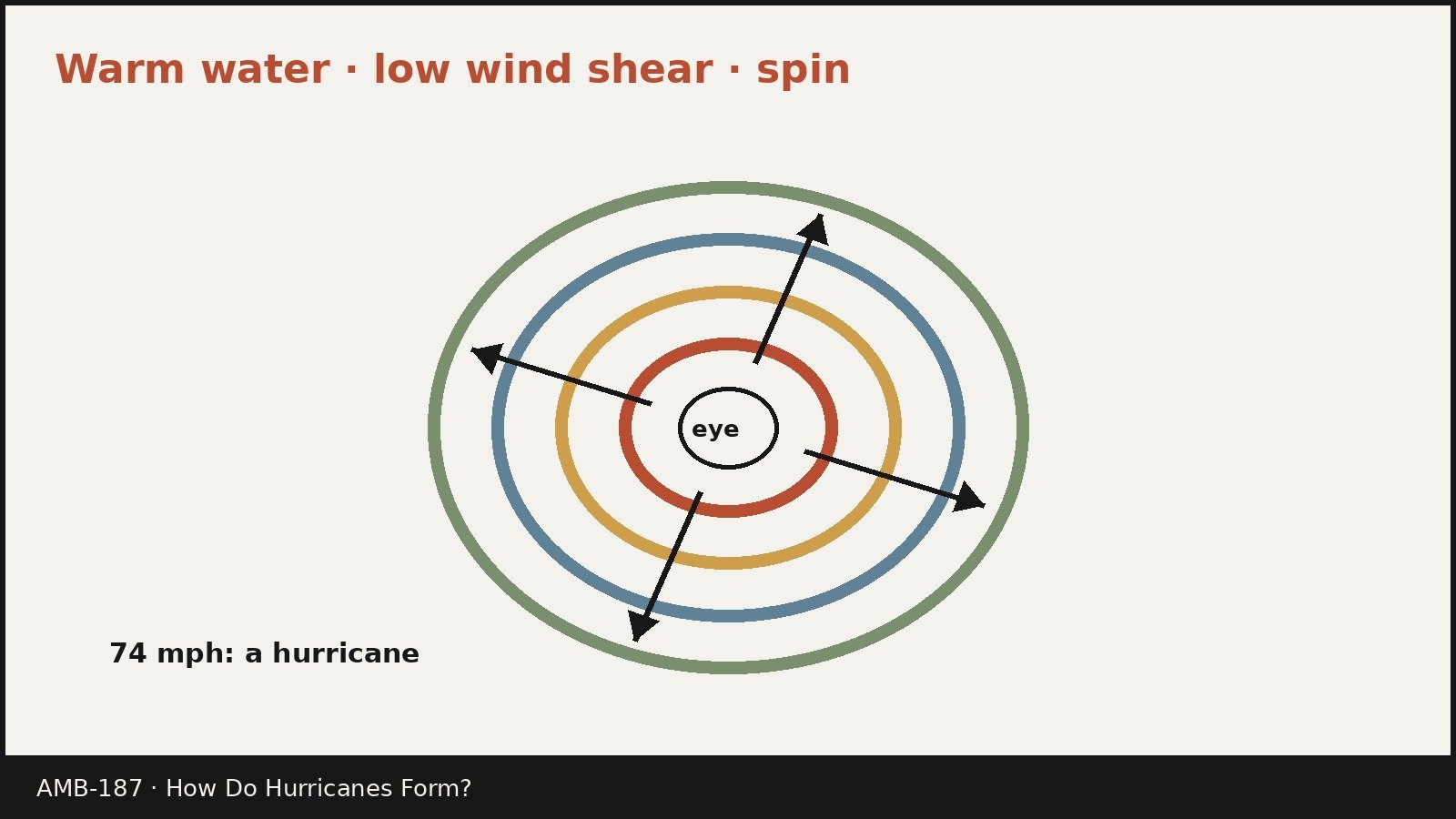
A mature hurricane has three main parts: the eye, the eyewall, and the rainbands.
The eye
The eye is the center of the storm: a relatively calm, generally clear area of sinking air and light winds. NOAA describes eye winds as usually not exceeding 15 miles per hour, and the eye as typically 20 to 40 miles across. An eye will usually develop when maximum sustained winds go above 74 miles per hour, and it is the calmest part of the storm.
The eye forms because inward spiraling air speeds up until centrifugal force, the outward pull from fast curved motion, balances the inward pull toward low pressure. Air then rises in a ring around the center, forming the eyewall, while some air from the top of the eyewall sinks into the center, suppressing clouds. NOAA notes that the exact cause is still not fully understood, but this is the leading explanation.
The calm of the eye can mislead. NOAA warns that people experiencing the light wind and fair weather of an eye may think the hurricane has passed, when in fact the storm is only half over, with eyewall winds returning shortly from the opposite direction. The eye is a pause, not an end.
The eyewall
The eyewall is the ring of tall thunderstorms surrounding the eye. It contains the heaviest rain and usually the strongest winds in the storm, where rising motion and condensation heat release are most intense. The eye can grow or shrink, and double, or concentric, eyewalls can form. In an eyewall replacement cycle, outer rainbands organize into a new outer eyewall that slowly moves inward and robs the inner eyewall of moisture and momentum. During that phase, the storm typically weakens. Eventually the outer eyewall may replace the inner one completely, and the storm can return to its previous intensity or, in some cases, become even stronger.
The rainbands and size
Rainbands are curved bands of clouds and thunderstorms that spiral away from the eyewall. They produce heavy bursts of rain and wind, and they can also produce tornadoes. Between bands there are sometimes gaps with little rain or wind, and bands grow more intense toward the eyewall.
Typical hurricane strength tropical cyclones are about 300 miles wide, according to NOAA, although size varies considerably. Size is not the same as intensity. A small hurricane can have very strong winds concentrated near its center, while a large hurricane can have weaker peak winds spread over a much wider area. Hurricane force winds can extend outward more than 150 miles from the eye in a large storm.
Where hurricanes form, and when
The main basins where tropical cyclones called hurricanes form are the North Atlantic, including the Caribbean Sea and the Gulf of America, the central North Pacific, and the eastern North Pacific, extending westward from Mexico and Central America. The Northwest Pacific produces typhoons, and the Indian Ocean and South Pacific produce tropical cyclones under that generic name.
Basin differences come from geography and atmospheric patterns. The Atlantic has a long stretch of warm water and a steady supply of tropical waves. The eastern Pacific has an earlier season start, with many storms moving westward over open ocean. The Northwest Pacific has a main season from July to November, but tropical cyclones there occur all year and there is no official typhoon season.
Seasons are official windows, not absolute limits. The Atlantic hurricane season runs from June 1 to November 30. The eastern Pacific season runs from May 15 to November 30. NOAA notes that 97 percent of Atlantic tropical cyclone activity occurs during the Atlantic season, but storms can and do occur outside it. The Atlantic peak is September 10, with most activity between mid-August and mid-October. The eastern Pacific peak is less sharp, in late August, with most activity between late June and early October.
Based on the 1991 to 2020 climate period, an average Atlantic season has 14 named storms, 7 hurricanes, and 3 major hurricanes. An average eastern Pacific season has 15 named storms, 8 hurricanes, and 4 major hurricanes. Individual seasons vary considerably around those averages, and a season with fewer storms can still produce a very damaging landfall.
Tracks follow broad steering patterns. Tropical cyclones forming between 5 and 30 degrees north latitude typically move toward the west at first. As they reach latitudes near 30 degrees north, they often turn toward the north and then northeast, caught by westerly winds in midlatitudes.
Why hurricanes weaken
Every hurricane ends, and the ways it ends reveal the same physics as formation, run in reverse.
Moving over land is the most familiar weakening mechanism. A hurricane over land loses its fuel supply. It is no longer over warm ocean water, so evaporation drops, rising air loses its heat and moisture source, and the feedback loop breaks. Land also adds friction. The rough surface slows surface winds, disrupts organized inflow, and helps fill the low pressure center. NOAA notes that storms weaken rapidly over land not only because of friction, but because the storm lacks the moisture and heat that the ocean provided to produce convection near the center. A weakening hurricane can still carry heavy rain far inland for days after winds drop below hurricane strength.
Moving over cooler water weakens a storm more gradually. As sea surface temperature falls below the warm threshold, evaporation weakens, thunderstorms become less vigorous, and pressure rises. Strong vertical wind shear can weaken a hurricane at any point in its life by tilting the storm, separating thunderstorms from the surface center, and disrupting the vertical alignment that the heat engine needs. Dry air intrusion can also weaken a storm by evaporating cloud droplets, cooling rising air, and creating sinking motion that breaks up thunderstorms.
Not all weakening comes from the environment. Eyewall replacement cycles can weaken a storm temporarily from within, and ocean mixing can weaken a storm from below as it churns cooler water to the surface. Some tropical cyclones do not simply fade. As they move into higher latitudes, they can undergo extratropical transition, changing from a warm cored tropical cyclone into a cold cored, frontal extratropical cyclone. The new system can still bring strong winds, heavy rain, and coastal flooding, but its structure and energy source are different.
How hurricanes are monitored, and common misunderstandings
Satellites track cloud patterns, sea surface temperature, moisture, and wind shear over whole ocean basins. Aircraft reconnaissance flies into storms to measure wind, pressure, temperature, and moisture directly. Computer models combine those observations with physics to forecast track and intensity. Track forecasts have improved greatly, but intensity forecasts, especially rapid strengthening or weakening, remain harder, because small changes in shear, moisture, ocean heat, or internal structure can shift the outcome.
Several misunderstandings recur. Warm water alone does not create a hurricane, because formation also needs a disturbance, moisture, low shear, instability, and spin. A hurricane is not a tornado: a tornado is a small, short lived vortex from a single thunderstorm, usually over land, while a hurricane is a large, long lived tropical cyclone that forms over ocean water over days. The eye is not a sign that the storm is over; it is a sign that the storm is organized, and the second half follows eye passage. Category is not a complete danger rating, because the Saffir-Simpson scale rates maximum sustained wind speed only, not storm surge, rainfall, flooding, size, forward speed, or tornado risk.
On climate, the picture from the UCAR and NOAA sources used here is careful. Ocean warming is linked to more intense hurricanes, with higher wind speeds, larger amounts of precipitation, and more risk of flooding. At the same time, the number of hurricanes each year is not certain to increase. Scientists predict more intense hurricanes, specifically Category 4 or 5 storms, as the climate continues to warm, even if total storm numbers do not rise in the same way.
For readers, the practical lesson is general, not personal. Official forecasts from NOAA and the National Hurricane Center, and from national meteorological services in other countries, are the authoritative source for any active storm. This article explains the general science. It does not give safety advice for any specific person, place, or storm, and official guidance for an active storm should always be followed from those official sources.
Frequently asked questions
How do hurricanes form in simple terms?
Hurricanes form when a weather disturbance over warm tropical ocean water organizes into a spinning storm. Warm, moist air rises, condenses into thunderstorms, and releases heat. That heat lowers surface pressure and pulls in more warm, moist air. With low wind shear, ample moisture, and enough spin from Earth’s rotation, the loop strengthens until winds reach tropical storm strength, then hurricane strength.
What temperature does the ocean need to be for a hurricane to form?
NOAA gives at least 26.5 degrees Celsius, about 80 degrees Fahrenheit, over a depth of about 50 meters as the warm water ingredient. The depth matters because a deeper warm layer keeps feeding the storm even as winds mix the ocean. Cooler or shallow warm water provides less fuel, and storms over such water usually struggle to form or strengthen.
Why do hurricanes need warm water?
Warm water supplies heat and moisture through evaporation. That warm, moist air rises and, when it condenses into clouds, releases latent heat. Latent heat powers the storm, lowers surface pressure, and drives the inflow that strengthens winds. Over land or cooler water, that fuel supply is cut off and the storm weakens.
What is the first stage of a hurricane?
The first stage is a tropical disturbance: a low pressure area with thunderstorms that has not yet developed a closed, organized circulation. If it organizes and gains a closed circulation with winds of 38 miles per hour or less, it becomes a tropical depression. At 39 miles per hour it becomes a tropical storm, and at 74 miles per hour it becomes a hurricane in the Atlantic and eastern Pacific.
Why do hurricanes spin counterclockwise in the Northern Hemisphere?
Because of the Coriolis effect from Earth’s rotation, combined with air flowing inward toward low pressure. In the Northern Hemisphere, that combination produces counterclockwise rotation around the center. In the Southern Hemisphere, it produces clockwise rotation. Near the equator, where the Coriolis effect is very weak, storms struggle to organize a spin, which is why they rarely form very close to the equator.
What is the difference between a hurricane, a typhoon, and a cyclone?
They are the same kind of storm, a tropical cyclone, with different regional names. In the North Atlantic, central North Pacific, and eastern North Pacific, the term hurricane is used. In the Northwest Pacific, the term typhoon is used. In the South Pacific and Indian Ocean, the generic term tropical cyclone is used. The difference is location, not storm type.
Why do hurricanes weaken over land?
A hurricane over land loses its warm ocean fuel supply. Evaporation drops, rising air loses heat and moisture, and the feedback loop breaks. Friction with the rough land surface also slows winds and disrupts inflow. The storm can still bring heavy rain far inland after winds weaken, because the moisture already in the system still falls as rain.
What is the eye of a hurricane?
The eye is the relatively calm, mostly clear center of a mature hurricane, where air sinks instead of rising. NOAA describes eye winds as usually not exceeding 15 miles per hour, and the eye as typically 20 to 40 miles across. The eyewall around it has the strongest winds and heaviest rain. Calm in the eye is temporary, with eyewall winds returning from the opposite direction after the eye passes.
Sources & references
- NOAA Ocean Service, How do hurricanes form? tropical wave starting point, warm water at least 26.5 degrees Celsius over a depth of 50 meters, thunderstorm activity, low wind shear, 74 miles per hour hurricane threshold, tropical cyclone definition, and the note that a hurricane does not always develop even when ingredients come together.
- NOAA Ocean Service, What is the difference between a hurricane and a typhoon? tropical depression, tropical storm at 39 miles per hour, hurricane at 74 miles per hour, regional names for the North Atlantic, central North Pacific, eastern North Pacific, Northwest Pacific, South Pacific, and Indian Ocean, ingredients list, potential tropical cyclone definition, and Atlantic season June 1 to November 30 with 97 percent of activity in season.
- NOAA JetStream, Tropical Cyclone Structure, eye, eyewall, and rainbands, eye size 20 to 40 miles and eye winds usually not exceeding 15 miles per hour, eye formation explanation using angular momentum and centrifugal force, eyewall replacement cycles, typical width about 300 miles, and hurricane force wind extent.
- NASA Space Place, How Do Hurricanes Form? tropical cyclone as the scientific term, hurricane name limited to Atlantic and eastern Pacific, warm moist air as fuel, rising air and low pressure, spin direction by hemisphere, eye formation, tropical storm at 39 miles per hour, hurricane at 74 miles per hour, Saffir-Simpson categories, and weakening over land.
- NOAA National Hurricane Center, Tropical Cyclone Climatology, nhc.depression 38 miles per hour or less, tropical storm 39 to 73 miles per hour, hurricane 74 miles per hour or higher, major hurricane 111 miles per hour or higher, typical westward then north and northeast tracks, Atlantic season June 1 to November 30 with 14 named storms, 7 hurricanes, and 3 major hurricanes on average for 1991 to 2020, eastern Pacific season May 15 to November 30 with 15 named storms, 8 hurricanes, and 4 major hurricanes on average, Atlantic peak September 10, and most Atlantic activity between mid-August and mid-October.
- UCAR Center for Science Education, Hurricanes, average hurricane width 340 miles, rotation direction by hemisphere, eye and eyewall description, Saffir-Simpson use in Atlantic and Eastern Pacific, storm surge as a temporary rise in sea level from winds pushing water toward the coast, North Atlantic season June 1 to November 30, and climate change links to more intense hurricanes, higher precipitation, and more flooding risk without certainty about total storm numbers.


