So, Which Is the Largest Rift Valley in Africa?
The answer geologists give is the East African Rift System, the feature most people know as the Great Rift Valley. The two names are used for the same vast system, though they emphasize different things. “East African Rift System” is the technical name for the active plate boundary. “Great Rift Valley” is the older, popular name, and it is usually applied to the whole line of valleys and lakes stretching from the Middle East deep into Africa.
The name itself has a story. British geologist John Walter Gregory explored central Kenya in the 1890s and published his account as The Great Rift Valley in 1896, a book that fixed the name in the public imagination. Geologists still honor him in the name of the system’s eastern branch, the Gregory Rift.
Why “largest”? Because by every common measure of a rift valley, this system is in a class of its own. Encyclopaedia Britannica calls it “one of the most extensive rifts on Earth’s surface,” and the U.S. Geological Survey notes that it is the only rift system in the world that is active on a continent-wide scale. No other rift valley combines this length, this depth of relief, this many great lakes, and this level of ongoing tectonic activity.
One honesty note before the numbers: geologists do not all draw the valley’s endpoints in the same place, so published length figures genuinely disagree. The sections below give the figures from the authorities consulted for this article and explain why they differ, so you get an honest picture rather than a single misleading number.
How Big Is It? The Measured Figures
Length
The headline figure most often quoted is about 6,400 kilometers (4,000 miles). That is the figure given by Encyclopaedia Britannica, and it measures the whole geological system: from Jordan in southwestern Asia, down the Red Sea, through eastern Africa, and all the way to Mozambique in the southeast. Some textbooks push the northern end even further, to Syria, but the 6,400 km figure is the standard reference length.
Two other respected figures describe a narrower definition. The Geological Society of London measures the East African Rift Valley itself, from the Red Sea to Mozambique, at 3,500 kilometers. The U.S. Geological Survey, which is describing the currently active continental rift rather than the whole historical system, gives about 3,000 kilometers, from the Afar triple junction in the Horn of Africa to western Mozambique, while noting that the system has propagated more than 3,000 kilometers southward and southwestward since rifting began.
None of these figures is wrong. They simply start and end the measuring tape at different places. For the broad “Great Rift Valley” that most readers picture, 6,400 km is the figure to use.
Width and relief
Britannica gives the system’s average width as 30 to 40 miles (48 to 64 kilometers), a long, narrow trench by continental standards, though it widens considerably in places such as the Turkana depression.
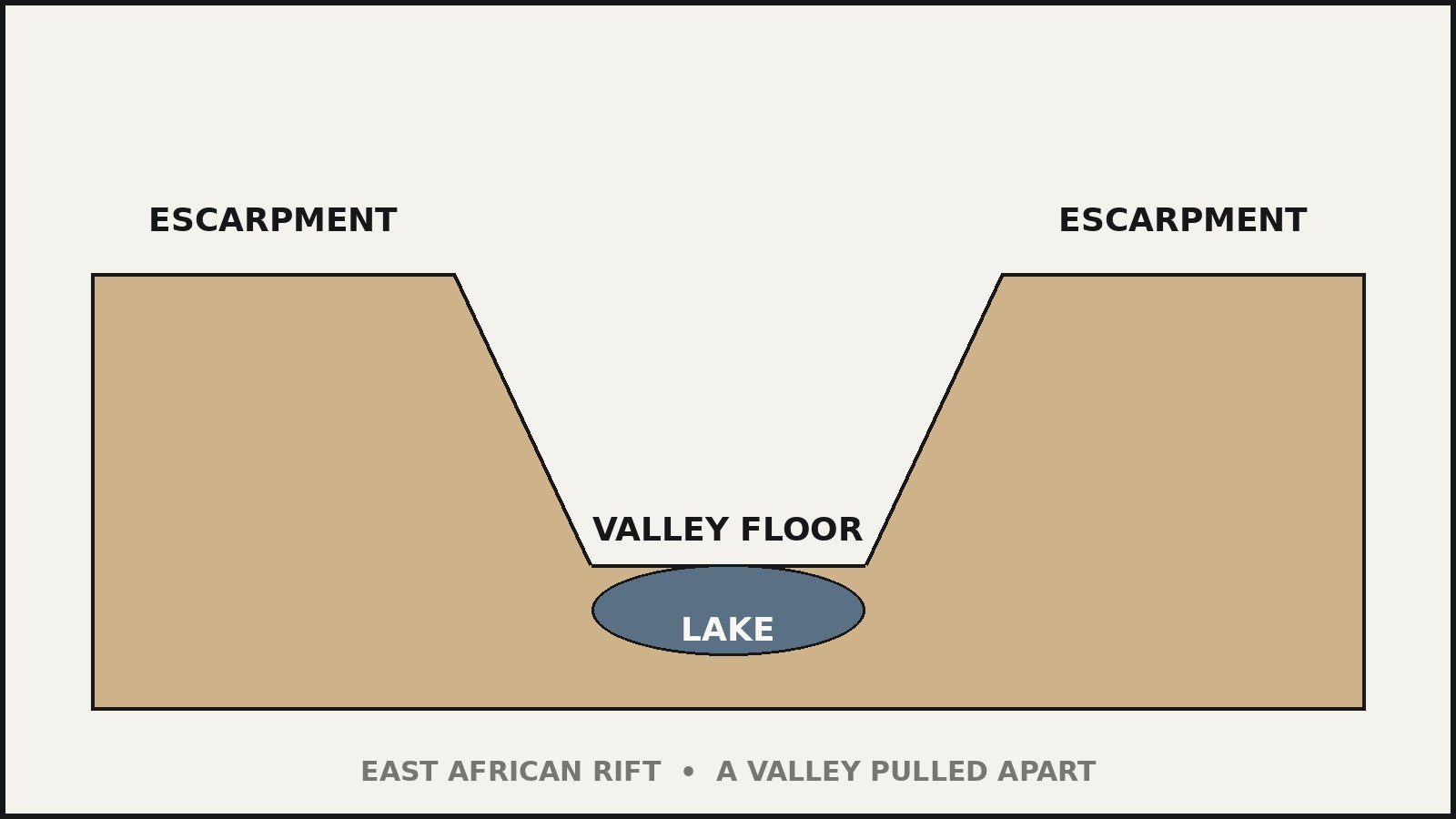
The valley’s drama comes from its relief, the height difference between the rift floor and the surrounding plateaus. Britannica reports that the adjacent plateaus typically drop 2,000 to 3,000 feet (600 to 900 meters) to the valley floor. In some places the escarpments are far more spectacular: at the Gikuyu and Mau escarpments in Kenya, the drop averages more than 9,000 feet (2,700 meters). These are cliff walls on a scale few landscapes on Earth can match.
Summary of the figures
| Measure | Figure | Source and definition |
|---|---|---|
| Length, broad system | About 6,400 km (4,000 miles) | Britannica; Jordan to Mozambique |
| Length, rift valley proper | About 3,500 km | Geological Society of London; Red Sea to Mozambique |
| Length, active continental rift | About 3,000 km | USGS; Afar triple junction to western Mozambique |
| Average width | 30 to 40 miles (48 to 64 km) | Britannica |
| Typical escarpment drop | 600 to 900 m (2,000 to 3,000 ft) | Britannica |
| Maximum escarpment drop | Over 2,700 m (9,000 ft) | Britannica; Gikuyu and Mau escarpments |
How the Rift Valley Formed
A continent pulling apart
The Great Rift Valley is a divergent plate boundary, a place where tectonic plates are moving away from each other. The Geological Society of London describes the mechanics plainly: the eastern portion of Africa, carried on the Somalian plate, is pulling away from the rest of the continent, carried on the Nubian plate. The crust stretches, thins, and eventually breaks along immense faults.
It is not a simple two-plate split. The Nubian and Somalian plates are also separating from the Arabian plate to the north, creating a Y-shaped rifting system. The three plates meet in the Afar region of Ethiopia at what geologists call a triple junction, the point where the whole system began and where rifting is most advanced.
The heat engine underneath
Rifting on this scale needs a driving force, and the Geological Society explains the favored mechanism: elevated heat flow from the hot upper mantle beneath Kenya and Ethiopia. This heat pushed the land upward, stretching and fracturing the brittle continental crust. Basalt lavas flooded out through fissures, and a series of normal faults generated the classic “horst and graben” landscape: long, dropped-down basins (grabens) separated by upraised blocks (horsts) that now form the valley’s escarpments. Most geologists link this heat to a mantle plume, a rising column of hot rock warming the crust from below, although the exact source of the heat remains debated.
The USGS adds deep-time detail: volcanism and faulting have been ongoing in East Africa since the Eocene, about 45 million years ago. A Paleogene mantle superplume beneath East Africa caused extension within the Nubian plate and raised a vast topographic dome known as the African superswell. During the Eocene to Oligocene (45 to 29 million years ago), widespread volcanism erupted across the rising Ethiopian plateau, with chains of volcanoes forming along the rift that was separating Africa from Arabia.
When it started
How old is the rift? The answers depend on which part of the story you are dating. Britannica says the system has been forming for some 30 million years, dating from the separation of Africa and the Arabian Peninsula. The Geological Society dates the East African Rift Valley itself to the Miocene, approximately 25 million years ago, originating at the Afar triple junction and extending southward over time. The USGS pushes the first stirrings back to about 45 million years ago. These are not contradictions: they describe the long, staged process by which an ancient zone of volcanism grew into the rift valley we see today. The safe summary is that the system began forming roughly 25 to 30 million years ago, with volcanic precursors stretching back further.
Still active today
This is not a fossil landscape. The USGS calls the East African Rift System the only rift system in the world that is active on a continent-wide scale, and notes that it experiences earthquakes as a direct result of the ongoing extension and the active magma beneath it. The Geological Society points to the eastern branch’s Erta Ale volcano in Ethiopia, which hosts a persistently active lava lake, as a vivid sign that the rift is still growing.
And the long-term future is extraordinary. The Geological Society explains that if rifting continues, the valley will sink lower and lower until ocean waters flood in, and new basaltic oceanic crust could form along the center, producing a narrow new ocean basin with its own mid-ocean ridge between the Nubian and Somalian plates. In effect, geologists are watching the birth of a future ocean, a process that takes tens of millions of years.
The Two Branches of the Rift
South of the Afar triple junction, the rift splits into two great arms that run roughly parallel for thousands of kilometers: the Eastern Rift and the Western Rift. They are geologically different in age, character, and scenery, and travelers experience them very differently.
The Eastern Branch: the Gregory Rift
The Eastern Rift Valley, also called the Gregory Rift after John Walter Gregory, is the branch most people picture. Britannica describes its full course: in the north it is occupied by the Jordan River, the Dead Sea, and the Gulf of Aqaba; it continues south along the Red Sea into Ethiopia’s Denakil Plain, then to Lakes Turkana, Naivasha, and Magadi in Kenya. Through Tanzania the rift becomes less obvious because its eastern rim is heavily eroded, but it continues south through the Shire River valley and the Mozambique Plain to the coast of the Indian Ocean near Beira.
The Geological Society adds the geological character: this is a volcanic-rich system that formed first, in the early Miocene. It makes up the Ethiopian and Kenyan rifts, and it includes Erta Ale in Ethiopia’s Afar region with its active lava lake. Because it is the older, more evolved branch, geologists describe parts of it as a mature rift system that has already produced enormous volumes of volcanic rock.
The Western Branch: the deep lake country
The Western Rift Valley takes a different route. Britannica describes it as a great arc extending northward from the northern end of Lake Nyasa (Lake Malawi), taking in Lakes Rukwa, Tanganyika, Kivu, Edward, and Albert. Most of these lakes are deep and fjordlike, Britannica notes, and some have floors well below sea level.
The Geological Society characterizes this branch as a younger, less volcanic system. It has comparatively little volcanism but much deeper earthquakes, and it is considered more seismically active than the eastern branch. Where the eastern branch is the model of a mature rift, the western branch is regarded as a good model of a young continental rift system. Its signature features are its lakes: long, narrow, and extraordinarily deep, cradled between steep rift walls.
The Great Lakes of the Rift
The rift valley is the world’s greatest collection of tectonic lakes, and they could fill an article each. These are the standouts.
Lake Tanganyika: the inland ocean
Lake Tanganyika, in the Western Rift, is the giant of the system. NASA’s Earth Observatory describes it as the world’s longest freshwater lake and the second deepest, with depths reaching 1,470 meters (4,820 feet), second only to Lake Baikal in Siberia. It holds about 17 percent of the world’s freshwater, and it supports roughly 1,500 species of animals, nearly half of which are found nowhere else.
Britannica places it in the western branch’s arc of lakes, and the Geological Society of London confirms its rank as the second deepest lake in the world. For scale, its maximum depth is more than four times the height of the Eiffel Tower, contained within a freshwater lake in the heart of Africa.
Lake Turkana: the Jade Sea
Lake Turkana in northern Kenya, on the Eastern Rift, is the world’s largest permanent desert lake. UNESCO’s World Heritage listing describes it as the largest desert lake in the world and Africa’s fourth largest lake, a long body of water dropping down the Rift Valley from the Ethiopian border: 249 kilometers from north to south, 44 kilometers at its widest, and about 30 meters deep. It is the most saline lake in East Africa, and it is nicknamed the Jade Sea for its startling green-blue color.
The lake’s three national parks (Sibiloi, Central Island, and South Island) cover 161,485 hectares, and UNESCO records that the area holds the world’s largest colony of Nile crocodiles and the largest Nile crocodile breeding ground in the world. It is also a celebrated fossil site, which the next section covers in detail.
The Kenya Lake System: flamingo country
On the floor of the Eastern Rift in Kenya sit three shallow, alkaline lakes: Bogoria, Nakuru, and Elementaita. Together they form the Kenya Lake System in the Great Rift Valley, inscribed on UNESCO’s World Heritage List in 2011. The property covers 32,034 hectares, and UNESCO’s inscription announcement gives the reasons: the lakes are home to 13 globally threatened bird species and some of the highest bird diversities in the world. They are the single most important foraging site for the lesser flamingo anywhere (Kenya’s National Museums record up to 4 million birds moving between the three lakes) and a major nesting and breeding ground for great white pelicans. The surrounding land holds black rhino, Rothschild’s giraffe, greater kudu, lions, cheetahs, and wild dogs, and the whole property is set among hot springs, geysers, and the steep rift escarpments.
Lake Rukwa and the contrast
Just 100 kilometers from Tanganyika, NASA’s Earth Observatory draws a striking contrast with Lake Rukwa: an alkaline lake with no outlets that averages only about 3 meters (10 feet) deep, whose water levels swing with rainfall and which sometimes splits into two basins. Long and short, deep and shallow, fresh and salty: the rift produces both within sight of each other.
Lake Malawi
Lake Nyasa, better known as Lake Malawi, anchors the southern end of the Western Rift’s arc. Britannica lists it as the starting point of the western branch’s great sweep northward. It is one of Africa’s largest lakes and a defining feature of the rift’s southern reach.
Volcanoes and Giant Mountains
The rift’s volcanism did not just fill the valley with lava. It raised some of Africa’s most famous mountains.
Mount Kilimanjaro, at 5,895 meters (19,340 feet), is the highest point in Africa. Britannica’s entry places the volcanic massif in northeastern Tanzania, about 160 kilometers east of the East African Rift System, and identifies it as one of the massifs produced by the rift’s volcanism. The mountain is actually three extinct volcanoes: Kibo in the center, Mawensi in the east, and Shira in the west. Only Kibo retains a permanent ice cap. The mountain was first climbed in 1889 by Hans Meyer and Ludwig Purtscheller, became a national park in 1973, and was designated a UNESCO World Heritage site in 1987.
Mount Kenya, at 5,199 meters (17,057 feet), is Africa’s second-highest peak and an extinct volcano shaped by the rift’s volcanic era, when UNESCO’s conservation assessment notes it may once have stood around 6,500 meters tall. Its jagged, glacier-carved summit sits almost exactly on the equator.
For live volcanism, the Geological Society points to Erta Ale in Ethiopia’s Afar region, whose crater holds a persistent active lava lake, one of the few on Earth. The rift is still building mountains, not just preserving old ones.
The Cradle of Humankind
If the rift valley has one claim that matters more than its size, it is this: its sediments hold the most important fossil record of human evolution anywhere on Earth. The connection between geology and paleontology is direct. UNESCO’s Lake Turkana listing explains that volcanic eruptions, lava flows, geological faulting within the Great Rift Valley, and the formation of sedimentary deposits together “assured preservation of fossil remains” that are significant for understanding the history of life, especially human evolution. The rift did not just host early humans. It buried them carefully enough for us to find them.
Olduvai Gorge: nearly four million years of ancestors
Olduvai Gorge, a 14-kilometer-long ravine inside Tanzania’s Ngorongoro Conservation Area, is one of the world’s great archaeological sites. UNESCO’s World Heritage description records that the area has yielded a sequence of evidence for human evolution and human-environment dynamics “collectively extending over a span of almost four million years to the early modern era.” The finds include the fossilized footprints at Laetoli, associated with the development of human bipedalism; a sequence of evolving hominin species in the gorge ranging from Australopiths such as Zinjanthropus boisei to the Homo lineage, including Homo habilis, Homo erectus, and Homo sapiens; an early form of Homo sapiens at Lake Ndutu; and remains in the Ngorongoro crater documenting the development of stone technology and the transition to iron. Several of the type fossils in the hominin lineage come from this site, and UNESCO judges that future research here is likely to reveal much more about the rise of anatomically modern humans.
Koobi Fora: five species in one place
On the eastern shore of Lake Turkana, the Koobi Fora deposits have been yielding fossils since 1969, when researchers discovered Paranthropus boisei. The discovery of Homo habilis followed, and UNESCO records the extraordinary result: the human and pre-human fossils include remains of five species, Australopithecus anamensis, Homo habilis/rudolfensis, Paranthropus boisei, Homo erectus, and Homo sapiens, all found within one locality. UNESCO states that the Koobi Fora deposits “have contributed more to the understanding of human ancestry and paleo-environment than any other site in the world.” The fossils also tell a climate story: Homo habilis lived here about two million years ago, when the now-petrified forests around the lake were growing in a moist forest-grassland, long before the present hot desert arrived.
Parks and Places to Experience the Rift
The rift valley is not just a geology lesson. It is one of the great travel corridors of the natural world, and several of its highlights are protected as national parks and World Heritage sites.
Ngorongoro Conservation Area, Tanzania. Spanning 809,440 hectares from the Serengeti plains to the eastern arm of the Great Rift Valley, this was established in 1959 as a pioneering multiple-land-use area where wildlife coexists with semi-nomadic Maasai pastoralists. It contains the Ngorongoro Crater, which UNESCO calls the world’s largest unbroken caldera, and Olduvai Gorge. Some 25,000 large animals live in the area, including black rhino, and well over one million wildebeest pass through as part of the annual Serengeti migration, alongside tens of thousands of zebras and gazelles.
Kenya Lake System, Kenya. The three UNESCO-listed lakes (Bogoria, Nakuru, Elementaita) combine flamingo spectacles on an unmatched scale with geothermal features: hot springs and geysers along the shores, particularly at Bogoria, set against the volcanic escarpments. Mammals in the surrounding protected areas include black rhino, Rothschild’s giraffe, lions, cheetahs, and wild dogs.
Lake Turkana National Parks, Kenya. Remote and starkly beautiful, the Sibiloi, Central Island, and South Island parks protect the Jade Sea, its fossil beds, and the world’s largest Nile crocodile colony. UNESCO notes that remoteness has preserved the area as a natural wilderness, and visitors should understand that infrastructure is poor and access is an expedition, not a day trip.
Mount Kilimanjaro National Park, Tanzania. Established in 1973 and inscribed by UNESCO in 1987, the park protects the mountain above the treeline and its forest corridors. Thousands of hikers attempt Kibo’s summit each year, making it the most climbed high mountain in Africa.
Which Countries Does the Great Rift Valley Cross?
Piecing together the system descriptions from Britannica and the Geological Society, the rift system touches, in order from north to south: Jordan (Jordan River and Dead Sea), then the Red Sea corridor, Ethiopia (Denakil Plain and the Main Ethiopian Rift), Kenya (Turkana and the central lakes), Tanzania (the eastern branch’s eroded southern reach), and on the western branch’s arc, Uganda, Rwanda, Burundi, and the Democratic Republic of the Congo (Lakes Albert, Edward, and Kivu), Zambia and Tanzania (Lake Tanganyika), and Malawi and Mozambique (Lake Malawi, the Shire valley, and the Mozambique Plain to the Indian Ocean at Beira). That is at least a dozen countries, which is part of why the valley is so hard to define neatly: it is not one country’s feature but a continent’s.
Is Africa Splitting in Two? The Future of the Rift
Yes, slowly. The Somalian plate is pulling away from the Nubian plate along the rift, and the plates creep apart at a rate of only a few millimeters per year, far too slowly for any person to notice. The Geological Society describes the eventual outcome: continued extension will sink the rift floor until ocean waters flood in, and new basaltic oceanic crust could form along its center, creating a narrow new ocean basin with its own mid-ocean ridge.
The USGS frames the scientific value of this process: because the East African Rift is the only rift system active on a continent-wide scale, it gives geologists a living view of how continental rifts develop over time into oceanic spreading centers like the Mid-Atlantic Ridge. The Red Sea and the Gulf of Aden, where the Nubian and Arabian plates have already separated, show what the next chapter looks like. The split will not complete for tens of millions of years, but Africa’s far future is an island continent: the Horn of Africa drifting away on its own plate.
Frequently Asked Questions
What is the largest rift valley in Africa?
The East African Rift, commonly called the Great Rift Valley. It is the largest rift valley in Africa and one of the most extensive rift systems on Earth’s surface, running thousands of kilometers from the Middle East to Mozambique.
How long is the Great Rift Valley?
About 6,400 kilometers (4,000 miles) on the broad definition, from Jordan to Mozambique (Encyclopaedia Britannica). Narrower geological definitions give about 3,500 kilometers for the valley proper (Geological Society of London) or about 3,000 kilometers for the currently active continental rift (USGS). The figures differ because they start the measuring tape at different places.
How wide and how deep is it?
It averages 30 to 40 miles (48 to 64 kilometers) wide. The surrounding plateaus typically drop 600 to 900 meters to the valley floor, and at the Gikuyu and Mau escarpments in Kenya the drop exceeds 2,700 meters.
Which countries does the Great Rift Valley pass through?
At least a dozen: Jordan, Ethiopia, Kenya, Tanzania, Uganda, Rwanda, Burundi, DR Congo, Zambia, Malawi, and Mozambique, plus the Red Sea corridor. The eastern branch runs through Ethiopia and Kenya; the western branch arcs through the Great Lakes countries.
Is the Great Rift Valley the largest rift valley in the world?
It is commonly described as the longest and most extensive rift system on Earth’s surface. Encyclopaedia Britannica calls it one of the most extensive rifts on Earth, and the USGS notes it is the only rift system active on a continent-wide scale.
Is Africa splitting apart?
Yes, but at a geological pace. The Somalian and Nubian plates are pulling apart along the rift at only a few millimeters per year. Over tens of millions of years, the rift could flood and become a new ocean basin.
What is the deepest lake in the rift valley?
Lake Tanganyika, at 1,470 meters (4,820 feet) deep, the world’s second deepest lake after Lake Baikal. It is also the world’s longest freshwater lake and holds about 17 percent of the planet’s freshwater.
Can you visit the Great Rift Valley?
Yes. The most accessible highlights include the Kenya Lake System (Nakuru, Bogoria, Elementaita), the Ngorongoro Conservation Area in Tanzania, and Mount Kilimanjaro National Park. Lake Turkana’s parks are spectacular but remote, with poor infrastructure.
Sources & references
- U.S. Geological Survey, "Seismicity of the Earth 1900-2013: East African Rift." About 3,000 km of active continental rift from the Afar triple junction to western Mozambique; only continent-wide active rift system; volcanism and faulting since the Eocene (about 45 Ma); Nubia/Arabia separation; Ethiopian flood basalts of the Eocene-Oligocene (45 to 29 Ma); southward propagation; seismicity from extension and magmatism.
- Encyclopaedia Britannica, "East African Rift System." About 4,000 miles (6,400 km) long, 30 to 40 miles (48 to 64 km) wide on average; two branches; course through the Jordan River, Dead Sea, Gulf of Aqaba, Red Sea, Denakil Plain, Lakes Turkana, Naivasha, and Magadi, the Shire River valley, and the Mozambique Plain to Beira; western arc through Lakes Rukwa, Tanganyika, Kivu, Edward, and Albert; deep fjordlike lakes; escarpment drops of 600 to 900 m typical, over 2,700 m at the Gikuyu and Mau escarpments; forming for some 30 million years; volcanism producing Kilimanjaro and Mount Kenya.
- The Geological Society of London, "East African Rift Valley." Somalian plate pulling from the Nubian plate; Y-shaped system with the Arabian plate meeting at the Afar triple junction; formation in the Miocene about 25 million years ago; about 3,500 km from the Red Sea to Mozambique; eastern (Gregory) Rift through Ethiopia and Kenya, volcanic-rich, including Erta Ale's active lava lake; western branch from Uganda to Malawi, deeper lakes including Tanganyika, less volcanic, more seismically active; mantle-plume heat flow, uplift, horst-and-graben faulting; future ocean-basin scenario.
- UNESCO World Heritage Centre, "Kenya Lake System in the Great Rift Valley." Inscription 2011; Lakes Bogoria, Nakuru, and Elementaita; 32,034 hectares; 13 globally threatened bird species; single most important foraging site for the lesser flamingo anywhere; major nesting and breeding ground for great white pelicans; black rhino, Rothschild's giraffe, greater kudu, lions, cheetahs, wild dogs.
- UNESCO World Heritage Centre, "Ngorongoro Conservation Area." 809,440 hectares; established 1959; spans from the Serengeti to the eastern arm of the Great Rift Valley; world's largest unbroken caldera; Olduvai Gorge, 14 km ravine; human-evolution evidence spanning almost four million years (Laetoli footprints, Australopiths including Zinjanthropus boisei, Homo habilis, Homo erectus, Homo sapiens, Lake Ndutu, stone technology and iron); about 25,000 large animals; wildebeest migration over one million.
- UNESCO World Heritage Centre, "Lake Turkana National Parks." Largest desert lake in the world; Africa's fourth largest lake; 249 km by 44 km, about 30 m deep; most saline lake in East Africa; "Jade Sea"; 161,485 hectares across Sibiloi, Central Island, and South Island parks; Koobi Fora finds from 1969 (Paranthropus boisei, Homo habilis about two million years ago); five species in one locality; world's largest Nile crocodile colony and breeding ground.
- NASA Earth Observatory, "A Tale of Contrasting Rift Valley Lakes" (June 20, 2019). Lake Tanganyika: world's longest freshwater lake, second deepest, depths to 1,470 m (4,820 ft), about 17 percent of the world's freshwater, about 1,500 animal species with nearly half endemic; Lake Rukwa: alkaline, averaging about 3 m deep, fluctuating, sometimes splitting into two basins.
- Encyclopaedia Britannica, "Kilimanjaro." Central cone Kibo at 19,340 feet (5,895 meters), highest point in Africa; about 100 miles (160 km) east of the East African Rift System; three extinct volcanoes (Kibo, Mawensi, Shira); permanent ice cap on Kibo; first ascent 1889; national park established 1973; UNESCO World Heritage site 1987.
- UNESCO/IUCN Conservation Outlook Assessment, "Mount Kenya National Park/Natural Forest." At 5,199 m, the second highest peak in Africa; an ancient extinct volcano active 3.1 to 2.6 million years ago and once thought to have risen to around 6,500 m; 12 remnant glaciers, all receding rapidly.


