Short answer
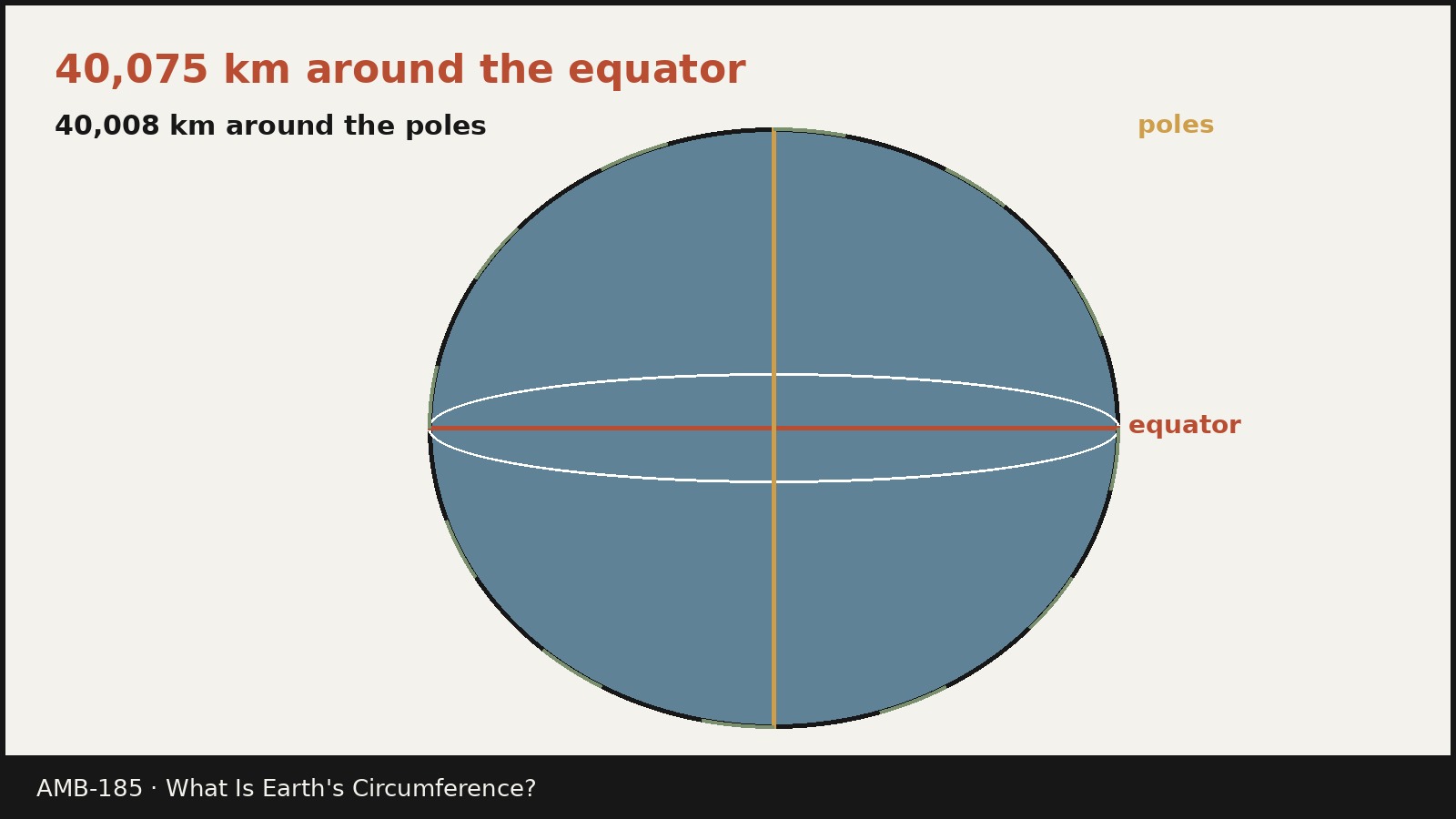
- Earth has two standard circumferences, because Earth is not a perfect sphere. Around the equator, Earth's circumference is about 40,075 kilometers (24,901 miles). Around the poles, along a meridian that passes through both poles, it is about 40,008 kilometers (24,860 miles). The difference is only about 67 kilometers (42 miles), or about 0.17 percent. If you need a single round figure for general use, about 40,000 kilometers (25,000 miles) is close enough for a rough sense of scale, but it is not a precise measurement. For any careful purpose, say which path you mean: equatorial or polar.
What “circumference” means for a planet
In school geometry, the circumference of a circle is the distance all the way around it. For a planet, the idea is the same, but the shape is more complicated. A planet is a three dimensional body, so there is no single loop that captures its size. Instead, geodesists, the scientists who measure Earth’s shape and size, describe particular loops.
The equatorial circumference is the loop around Earth’s widest part, the equator. The polar circumference, also called the meridional circumference, is the loop that runs from one pole to the other and back again, following a meridian, which is a line of longitude, on one side of the planet and the opposite meridian on the other side. Both loops are real paths on Earth’s surface, at least in the idealized sense used for these figures. Neither loop is the only measure of Earth’s size, and neither should be quoted without saying which one it is. That is the central point of this article, and it is the reason so many short answers online seem to disagree: they are often answering with different loops.
A third figure sometimes appears: the mean circumference, about 40,041 kilometers (24,881 miles). This is simply the average of the two figures, a useful summary number, not a path you could walk. Treat it as an average, not as a third route around the planet.
| Loop | Kilometers | Miles | What it measures |
|---|---|---|---|
| Equatorial circumference | 40,075.017 | 24,901.461 | Distance around the equator |
| Polar (meridional) circumference | 40,007.863 | 24,859.734 | Distance over both poles and back |
| Difference | 67.154 | 41.728 | How much longer the equatorial loop is |
| Mean of the two (average, not a path) | 40,041.440 | 24,880.597 | Simple average of the two figures above |
The precise figures come from the standard Earth model described later in this article. Rounded figures, 40,075 kilometers and 40,008 kilometers, are what most readers need. The extra decimal places matter for surveying and satellite work, not for general reading, and they describe a smooth mathematical model of Earth, not a claim that the real, bumpy surface has been measured to the nearest meter all the way around.
Why there are two answers: Earth is an oblate spheroid
Earth spins on its axis once a day. That spin throws material very slightly outward at the equator, in the same way that a spinning ball of soft dough flattens and widens. The result is that Earth bulges at the equator and is slightly flattened at the poles. Geodesists call this shape an oblate spheroid: a sphere squashed along its axis of rotation.
The size of the effect is small compared with Earth’s overall size, but it is large enough to measure precisely. Earth’s equatorial radius, the distance from Earth’s center to the equator, is 6,378.137 kilometers (3,963.191 miles). Earth’s polar radius, the distance from Earth’s center to either pole, is 6,356.752 kilometers (3,949.903 miles). The equatorial radius is therefore about 21.385 kilometers (about 13 miles) longer than the polar radius. Double those radii to get diameters: the equatorial diameter is about 12,756 kilometers (7,926 miles), and the polar diameter is about 12,714 kilometers (7,900 miles). The difference in diameter is about 43 kilometers (27 miles).
Flattening is the standard way to express how squashed the shape is: the difference between the equatorial and polar radii divided by the equatorial radius, about 1/298.257 for the standard Earth model. If Earth were shrunk to a globe one meter across, the difference between its diameters would be only about 3 millimeters. You would not notice it by eye, and a classroom globe can safely ignore it, but a navigation system that ignored it would place positions wrong by kilometers.
This is also why the two circumferences differ by only 67 kilometers. The bulge is real, but it is a small fraction of Earth’s size. A difference of 0.17 percent is enough to matter for science and navigation, and small enough that a single rounded figure, 40,000 kilometers, works fine for casual conversation.
How big is 40,075 kilometers, in everyday terms?
Large numbers are hard to picture, so it helps to translate the equatorial circumference into journeys. The examples below are simple arithmetic, not travel advice, and they assume nonstop travel at a constant speed, which no real journey achieves.
If you walked 40 kilometers (about 25 miles) every day without a rest day, walking the equatorial circumference would take about 1,002 days, or about two years and nine months. That assumes you could walk on water as well as land, which of course you cannot, so treat it as a scale illustration, not a route.
If you drove at a steady 100 kilometers per hour (about 62 miles per hour) without stopping, the same loop would take about 401 hours, or about 16.7 days. At a cruising speed of about 900 kilometers per hour (about 559 miles per hour), a jet would take about 44.5 hours to cover the same distance. These figures are not flight times: a real flight follows a different path, stops, and flies above the surface.
Another useful scale is one degree of longitude at the equator: the equatorial circumference divided by 360, or about 111.32 kilometers (69.17 miles). That is why map readers often use about 111 kilometers as a rough rule for one degree near the equator. Away from the equator, lines of longitude converge toward the poles, so one degree of longitude covers a shorter ground distance.
The spin of Earth gives one more scale. A point on the equator travels the full equatorial circumference in one rotation. Dividing 40,075 kilometers by 24 hours gives about 1,670 kilometers per hour (about 1,038 miles per hour). That is the approximate speed of Earth’s surface at the equator relative to Earth’s center. It is not a speed you feel, because everything around you, including the air, moves with you.
Eratosthenes: the first measurement with surviving details
The first known scientific measurement of Earth’s circumference, in the sense of one whose method survives in enough detail to follow, was made by the Greek scholar Eratosthenes in the third century BCE. He worked in Alexandria, Egypt, and his account survives only in a simplified version written later by the Greek astronomer Cleomedes. Eratosthenes’s own book has not survived, and historians note that his actual procedure was probably more complicated.
The method used two Egyptian cities: Syene, modern Aswan, and Alexandria. According to the simplified account, at noon on the summer solstice the Sun stood directly overhead at Syene, so a vertical rod cast no shadow and sunlight shone straight down a deep well. At the same date and time in Alexandria, sunlight fell at an angle of about 7.2 degrees from the vertical, which is one fiftieth of a full circle. Eratosthenes treated the Sun’s rays as effectively parallel, because the Sun is so far away, so that angle also measured the fraction of Earth’s curvature between the two cities.
The rest was proportion. If the angle between the two cities is one fiftieth of a circle, then the distance between them must be one fiftieth of Earth’s circumference. The distance between Alexandria and Syene was reported as about 5,000 stadia, measured by professional surveyors known as bematists. Multiplying 5,000 stadia by 50 gives 250,000 stadia for Earth’s circumference. Pliny the Elder later quoted a revised figure of 252,000 stadia, and historians debate whether Eratosthenes himself made that revision to simplify later calculations.
How good was the result? That depends on the length of the stadion, the ancient unit used, and that length is not known exactly. Britannica notes that the exact length of the units Eratosthenes used is doubtful, so the accuracy of his result is uncertain, but it was certainly in the right range, possibly within 0.5 to 17 percent of the modern value. Using a stadion of about 157.5 meters, 250,000 stadia converts to about 39,375 kilometers, which is within about 2 percent of the modern equatorial figure. Using a stadion between 155 and 160 meters, the 252,000 stadia figure converts to roughly 39,060 to 40,320 kilometers, an error between about 2.4 percent below and 0.8 percent above the modern value. In other words, the method was sound and the answer was remarkably close, but the exact percentage error cannot be pinned down without knowing exactly which stadion he used.
The simplified account also rests on approximations that are not strictly true. Syene lies somewhat less than one degree north of the Tropic of Cancer, so the Sun was not perfectly overhead there, and it is about 3 degrees of longitude east of Alexandria, so the two cities are not exactly on the same meridian. A modern repeat with accurate data gives about 40,074 kilometers, very close to the modern value, which shows the geometry is correct even though the ancient inputs were approximate. It was the first time careful observation, geometry, and a measured ground distance were combined to size a planet.
Later measurements: from stars to national surveys
Eratosthenes was not the last ancient scholar to try. Posidonius, working a century or so later, used the star Canopus: he compared how high the star rose at Rhodes and at Alexandria, took the difference as one forty-eighth of a circle, and multiplied a reported distance of 5,000 stadia by 48 to get 240,000 stadia. With a stadion of about one tenth of a modern statute mile, that converts to roughly 39,000 kilometers, again not far from the modern value. But a different report of his work, passed on by Strabo, used a shorter distance between the cities and gave 180,000 stadia, or roughly 29,000 kilometers, which is about 28 percent too low. The confusion shows why ancient results must be read with their unit conversions attached: the same name, stadion, covered different lengths in different places and times, and a result quoted without its stadion is hard to judge.
Around 830 CE, astronomers working for the caliph al-Ma’mun measured a meridian arc between Tadmur (Palmyra) and Raqqa in modern Syria and calculated a circumference within about 15 percent of the modern value, and possibly much closer. The exact accuracy is uncertain because converting medieval Arabic units to modern units is itself uncertain. Two centuries later, al-Biruni devised a method needing only one observer: from a mountain of known height, he measured how far below the horizontal the horizon appeared to dip, and used trigonometry to work out Earth’s radius. His instruments limited his accuracy, and he accepted the earlier al-Ma’mun value. The episode shows that a clever method still depends on the quality of its measurements.
From the seventeenth century onward, European surveyors replaced single arcs with chains of triangles. By measuring one baseline on the ground very carefully and then measuring angles across a network of triangles, they could extend a measured arc over hundreds of kilometers without pacing every step. In 1617, the Dutch scientist Willebrord Snellius assessed Earth’s circumference at 24,630 Roman miles, or about 24,024 statute miles, a few percent low. His triangulation method was the future of geodesy: it turned Earth’s measurement from a single clever observation into a repeatable survey.
Why units of length carry Earth’s size in their history
Two everyday units were once defined from Earth’s circumference, which is why the modern figures are close to, but not exactly, round numbers.
The nautical mile grew out of navigation. A full meridian circle has 360 degrees of 60 minutes of arc each, or 21,600 minutes of arc, and early navigators treated one minute of latitude as a natural unit of distance at sea. That is why Earth’s polar circumference is nearly 21,600 nautical miles: close to that number because the unit was designed from the meridian, but not exactly, because the modern nautical mile is fixed by definition rather than by a fresh measurement of Earth.
The meter has a similar story. In 1793, France defined the meter so that Earth’s polar circumference would be 40,000 kilometers: the meter was one ten-millionth of the distance from the equator to the North Pole along a meridian through Paris. The French Academy of Sciences commissioned Jean-Baptiste Joseph Delambre and Pierre Mechain to measure a meridian arc between Dunkirk and Barcelona to fix the length. Their survey was an enormous undertaking, and the prototype meter bar made from it turned out to be about 0.2 millimeters shorter than the original definition, an error of about 0.02 percent, because Earth’s flattening had been miscalculated. The bar became the standard anyway, and the meter has since been redefined in terms that no longer depend on Earth at all. That history explains the near coincidence that still puzzles readers: the polar circumference is 40,008 kilometers, just 8 kilometers more than the 40,000 kilometers the meter was designed to produce. The closeness is a legacy of the definition, not a coincidence and not a rounding error in modern measurement.
How the modern figures are measured
No one has ever wrapped a tape measure around Earth, and no modern figure comes from a single measurement. The modern figures come from combining many kinds of measurement into one consistent model.
The foundation is the reference ellipsoid: a smooth mathematical surface, an ellipse rotated around its short axis, that approximates Earth’s overall shape. The standard ellipsoid used by the Global Positioning System (GPS) is the World Geodetic System 1984, or WGS 84, ellipsoid, with an equatorial radius of 6,378,137 meters and a flattening of 1/298.257223563. The equatorial circumference follows directly from the circle formula, circumference equals 2 times pi times radius. The polar circumference cannot use the same simple formula, because a meridian loop on an ellipsoid is an ellipse, not a circle, and the perimeter of an ellipse has no simple closed formula. It is computed numerically from the ellipsoid parameters.
The ellipsoid parameters themselves come from a combination of techniques. Satellite laser ranging bounces laser pulses off reflectors on satellites and times their return to fix satellite orbits and ground station positions very precisely. Very long baseline interferometry compares the arrival times of radio signals from distant quasars at widely separated telescopes to measure the distance and orientation between them. Global navigation satellite systems, including GPS, give continuous positions for receivers and ground stations all over the planet. Ground surveys, including precise leveling and gravity measurements, tie those space based results to marks on the ground. Together, these methods fix the size and shape of the ellipsoid far more precisely than any single arc measurement could.
Gravity missions add a different kind of information. The Gravity Recovery and Climate Experiment (GRACE), a joint NASA and German mission, used two identical spacecraft flying about 220 kilometers apart in polar orbit, measuring changes in the distance between them with a microwave ranging system to map Earth’s gravity field. Its successor, GRACE Follow-On, launched in 2018, continues that work. Gravity data do not change the ellipsoid figures directly, but they reveal how mass is distributed inside Earth and how it moves, for example in groundwater, ice sheets, and ocean currents. That matters because the real Earth is not the smooth ellipsoid: it has mountains, ocean trenches, and a lumpy gravity field.
The surface that best represents global mean sea level is called the geoid. The National Oceanic and Atmospheric Administration (NOAA) describes the geoid as a model of global mean sea level used to measure precise surface elevations. Imagine the oceans with tides, currents, winds, and weather removed: the water would settle into a smoothly undulating surface, rising where gravity is stronger and sinking where it is weaker. Extended through the continents, that surface is the geoid, and it defines zero elevation. It departs from the ellipsoid by tens of meters in places, which sounds large until compared with Earth’s radius of more than 6,000 kilometers. That is why the standard circumferences are defined on the ellipsoid, not on the real bumpy surface: they answer “how big is Earth as a planet” rather than “how long is a particular walkable path.”
Finally, the figures are stable but not frozen. Tectonic plates move, ice melts, and mass shifts, so Earth’s detailed shape changes slightly over time, by millimeters to centimeters per year at a given place, far below the rounding of the headline figures. The equatorial circumference will not become 40,076 kilometers in a reader’s lifetime because of plate motion, though refined models could shift its third decimal place.
The mathematics, worked through
Readers who want to check the figures need only two ideas and a calculator.
First, the equatorial circumference. Earth at the equator is treated as a circle with radius 6,378.137 kilometers. The circumference of a circle is 2 times pi times its radius. So the calculation is 2 times 3.14159265 times 6,378.137, which equals 40,075.017 kilometers. To convert to miles, multiply by 0.621371: 40,075.017 times 0.621371 equals 24,901.461 miles. The commonly quoted rounded figures, 40,075 kilometers and 24,901 miles, are these results rounded to the nearest whole unit.
Second, the polar circumference. A meridian loop is an ellipse with a long semi-axis equal to the equatorial radius (6,378.137 kilometers) and a short semi-axis equal to the polar radius (6,356.752 kilometers). The perimeter of an ellipse is computed numerically; the standard result is 40,007.863 kilometers, or 24,859.734 miles. Subtracting gives the difference: 40,075.017 minus 40,007.863 equals 67.154 kilometers. As a percentage of the equatorial figure, that is 67.154 divided by 40,075.017, times 100, or about 0.17 percent.
A common mistake is to apply the circle formula to the polar radius and call the result the polar circumference. That calculation, 2 times pi times 6,356.752, gives about 39,941 kilometers, which is not the polar circumference. It is the circumference of a circle whose radius equals the polar radius, a circle that does not exist as a loop on Earth’s surface. The polar loop is longer because it must travel out to the equatorial radius on both sides of the planet as well as in to the poles, and the ellipse calculation accounts for that.
Another common confusion is between circumference and diameter. Earth’s equatorial diameter is about 12,756 kilometers, roughly a third of its circumference, since circumference is pi times diameter. The diameter is the straight line through Earth’s center. The circumference is the journey around the outside.
What Earth’s circumference is not
Three distinctions prevent the most common mix-ups.
First, Earth’s circumference is not the length of its orbit around the Sun. The orbital path is a different, vastly larger loop that belongs to a different question, and quoting it here would only invite confusion between going around Earth and going around the Sun.
Second, the circumference is not a distance you can travel in a straight line. A flight from one city to its antipode, the point diametrically opposite on the globe, covers half a great circle, about 20,000 kilometers along the surface, not the full circumference. A round the world flight follows winds, fuel stops, and airspace, not the equator or a meridian, so its distance is its own figure.
Third, the circumference is not fixed by the equator alone. Some short answers quote only 40,075 kilometers and present it as “the” circumference. That figure is correct for the equator, and it is the most commonly quoted figure, but presenting it without the polar figure hides the fact that Earth is flattened. A careful answer names both, explains why they differ, and says which one is meant when only one is quoted. That is the standard this article follows, and it is the reason the short answer at the top gives both figures before anything else.
Frequently asked questions
What is Earth’s circumference in miles?
Around the equator, Earth’s circumference is about 24,901 miles. Around the poles, it is about 24,860 miles. The difference is about 42 miles. For a rough figure, 25,000 miles is close, but it is a rounding, not a measurement.
What is Earth’s circumference in kilometers?
Around the equator, it is about 40,075 kilometers. Around the poles, it is about 40,008 kilometers. The difference is about 67 kilometers.
Why do different sources give different numbers?
Most differences are rounding, or a different choice of loop. A source that says 40,075 kilometers is giving the equatorial figure; 40,008 kilometers is the polar figure; 40,000 kilometers is a rounding for general use; 40,041 kilometers is the average of the two. Small differences in the third decimal place come from different reference ellipsoids or rounding. None of these is a contradiction once the loop and the rounding are stated.
Is Earth a perfect sphere?
No. Earth is an oblate spheroid: slightly flattened at the poles and slightly bulging at the equator because of its rotation. The flattening is about one part in 298, so Earth looks spherical to the eye and in photographs, but precise measurement shows the difference. The real surface is also bumpy with mountains and ocean basins, and the geoid, the mean sea level surface, undulates with gravity. The spheroid is a smooth model, not a photograph.
How did Eratosthenes measure Earth’s circumference without satellites?
He compared the angle of the Sun at noon on the summer solstice at two Egyptian cities, Syene and Alexandria. At Syene the Sun was effectively overhead, while at Alexandria sunlight fell about 7.2 degrees from the vertical, one fiftieth of a circle. Multiplying the reported distance between the cities, about 5,000 stadia, by 50 gave about 250,000 stadia. Converted with a stadion of about 157.5 meters, that is about 39,375 kilometers, within a few percent of the modern value. The exact accuracy is uncertain because the exact length of his stadion is not known.
What is the difference between circumference, diameter, and radius?
The radius is the distance from Earth’s center to its surface: about 6,378 kilometers at the equator and about 6,357 kilometers at the poles. The diameter is twice the radius, a straight line through the center: about 12,756 kilometers at the equator and about 12,714 kilometers at the poles. The circumference is the distance around the outside: about 40,075 kilometers at the equator and about 40,008 kilometers around the poles. Circumference is pi times diameter for a circle.
Can you walk around Earth?
There is no continuous walkable equatorial path: most of the equator is ocean. Recorded circumnavigations combine walking, sailing, and other transport, and their routes are far longer than a single great circle because they follow land, weather, and logistics rather than a geometric loop. The circumference is a measurement of the planet, not a trail.
Does Earth’s circumference change?
The headline figures are effectively stable for general purposes. Plate motion, ice loss, and mass redistribution change Earth’s detailed shape by small amounts, and refined models can shift the third decimal place. They do not change the rounded figures of 40,075 kilometers and 40,008 kilometers on any timescale relevant to a reader. If a future ellipsoid replaced WGS 84, the figures could shift slightly, and a careful source would say so.
Sources & references
- NASA, Goddard Space Flight Center, "Imagine the Universe: The Earth" (earth_info): equatorial diameter 12,756 kilometers; equatorial radius 6,378 kilometers; polar radius 6,357 kilometers; Eratosthenes method, 5,000 stadia, 7.2 degrees, 250,000 stadia, and modern values from orbiting spacecraft.
- Encyclopaedia Britannica, "Eratosthenes": first measurement of Earth's size for which details are known; Syene about 800 kilometers southeast of Alexandria; angle about 7.2 degrees; 250,000 stadia; stadion length doubtful, accuracy uncertain, possibly 0.5 to 17 percent from the modern value; account preserved in Cleomedes's Meteora.
- Wikipedia, "Earth's circumference" (used for the standard WGS 84 based figures and their history, cross-checked against the arithmetic in this article): equatorial circumference 40,075.017 kilometers (24,901.461 miles); polar circumference 40,007.863 kilometers (24,859.734 miles); difference 67.154 kilometers (41.728 miles), about 0.17 percent; Eratosthenes, Posidonius, al-Ma'mun, al-Biruni, Snellius, Gunter, and the French meter history.
- National Oceanic and Atmospheric Administration (NOAA), Ocean Service, "What is the geoid?": geoid as a model of global mean sea level used for precise surface elevations; radius larger at the equator than at the poles due to rotation; geoid as the surface that defines zero elevation.
- European Space Agency, Earth Online, "GRACE Overview": GRACE as a joint NASA and German mission using a microwave ranging system between two spacecraft about 220 kilometers apart in polar orbit to map Earth's gravity field; GRACE Follow-On launched in 2018.
- WGS 84 defining parameters as reported in the National Geospatial-Intelligence Agency WGS 84 standardization document (NGA.STND.0036_1.0.0_WGS84, Table B.1, opened and read in QA): semi-major axis 6,378,137.0 meters; flattening 1/298.257223563. All kilometer and mile conversions in this article were recomputed by the writer from these parameters and are not copied conversions.


