Short answer
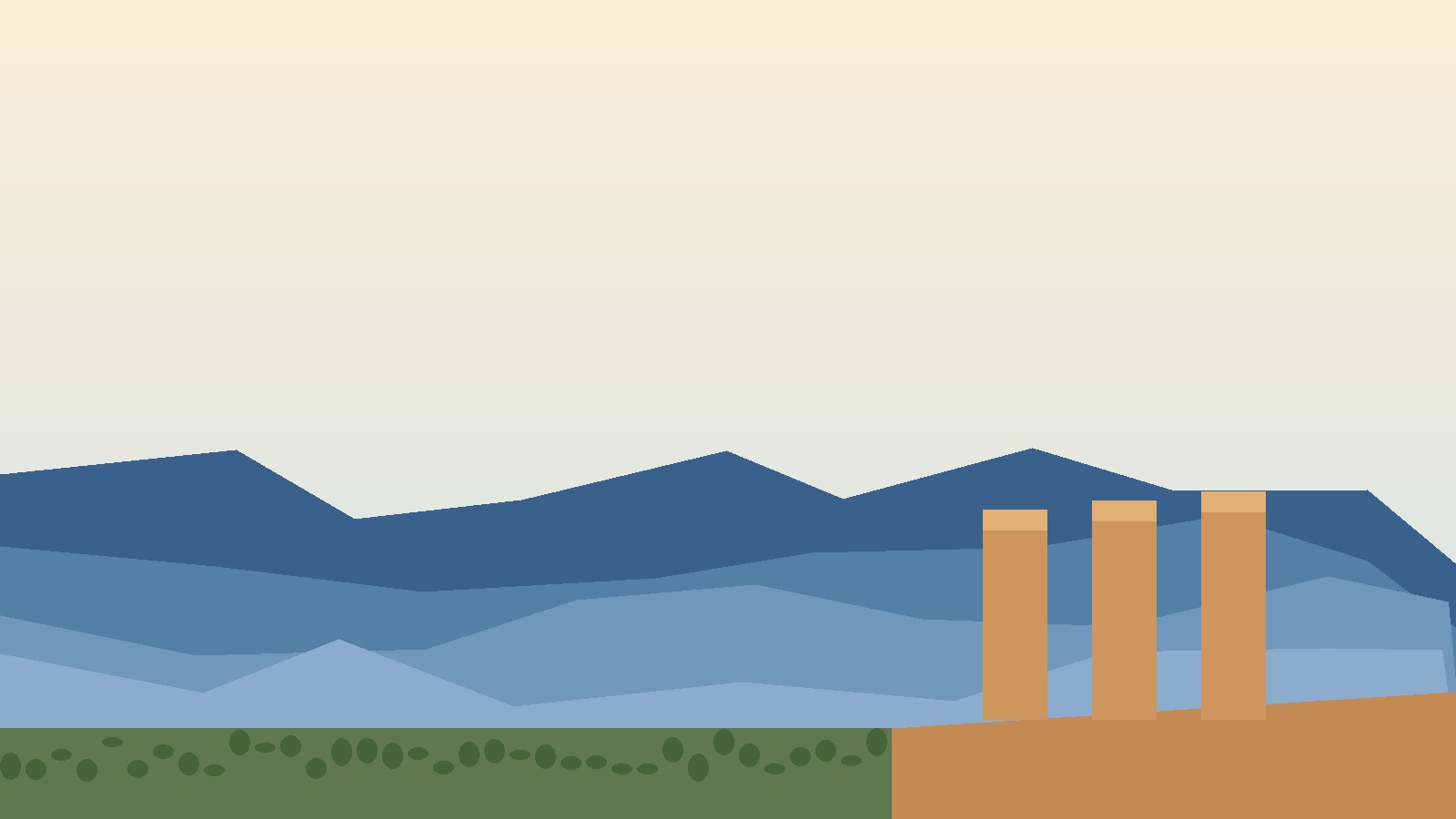
- Australia the Blue Mountains means the mountainous region in New South Wales, west of Sydney, whose forested valleys and sandstone cliffs often appear blue from a distance. The blue look comes from fine droplets released by eucalyptus trees, which scatter blue light. The region is not a single sharp mountain peak. It is mainly a high sandstone plateau cut by deep valleys and gorges, with towns strung along a highway and a railway line, and with much of the surrounding country protected as national parks. The wider protected landscape is called the Greater Blue Mountains Area, inscribed on the World Heritage List in 2000 for its eucalypt forests and wildlife. Its best known landmark is the Three Sisters, three sandstone pillars above the Jamison Valley at Katoomba, seen from Echo Point lookout. The region also carries a long human history, from Aboriginal occupation and custodianship over many thousands of years to the 1813 ridge route of Gregory Blaxland, William Lawson, and William Charles Wentworth, which opened a way through country that had blocked colonial expansion west from Sydney. If you are searching for "australia the blue mountains," this is almost certainly the place you mean, but the name alone is not enough to be sure. Jamaica also has a Blue Mountains range, also a World Heritage area. This article explains the Australian region first, then gives a short check to tell the two apart.
Where the Blue Mountains Are
The Blue Mountains region sits in New South Wales, in southeastern Australia, and forms part of the western edge of the Greater Sydney area. Its foothills start about 50 kilometers west of the center of Sydney, close to Penrith. A visitor can leave Sydney in the morning and be above a forested valley by late morning.
Exactly where the region begins and ends varies, because it is only part of a larger mountainous area linked to the Great Dividing Range. One definition used in reference works dates to 1970: bounded by the Nepean and Hawkesbury rivers in the east, the Coxs River and Lake Burragorang to the west and south, and the Wolgan and Colo rivers to the north, in the central Sydney Basin. That explains why maps differ: one may show the range, another the local government area, and a third the national park, all using the same name for overlapping areas.
The distinction matters when you plan. The region is the broad area. The range is the mountains and plateau escarpments within it, running about 96 kilometers in a generally southeasterly direction. Blue Mountains National Park is one of eight protected areas in the Greater Blue Mountains Area, and a council lookout such as Echo Point can sit on the park boundary rather than inside it. Think of three layers: region, range and plateau, and protected estate.
Why They Are Called Blue
The name comes from the blue haze over the valleys. It is not smoke or a photographic trick. Eucalyptus trees release volatile oils, and fine droplets from those oils, together with dust and water vapor, scatter short wavelength light. Short wavelength light is predominantly blue, so distant forested ridges take on a blue tint while closer trees still look green. The effect is strongest when you look across several ridges at once, because each layer of haze adds to the next. A single tree close up does not look blue. A valley full of eucalyptus forest, seen from a lookout several kilometers away, does.
Light, humidity, distance, and the angle of the sun change the effect. The sandstone itself is warm in color, often yellow, orange, or brown. The blue is in the air above the forest, not in the stone.
A Plateau, Not a Row of Peaks
Visitors expecting pointed peaks are often surprised. The Blue Mountains are better described as an uplifted plateau deeply cut by rivers. The Australian Government’s heritage description calls the Greater Blue Mountains Area a deeply incised sandstone plateau, rising from less than 100 meters above sea level to about 1,300 meters at its highest point, with basalt outcrops on the higher ridges. In Blue Mountains National Park itself, the country is an uplifted plateau dissected by larger rivers, not a chain of separate cones.
That shape explains the views: you stand on a level clifftop above a valley that drops hundreds of meters below you, and a valley walk must climb steeply back out. It also explains why crossing was so hard for early colonial travelers, who faced a maze of steep sided valleys, gorges, dense scrub, and cliffs that blocked routes following rivers upstream.
The First Peoples of the Blue Mountains
The Greater Blue Mountains Area spans the traditional Country of six Aboriginal language groups named by the New South Wales Government: Darkinjung, Dharawal, Dharug, Gundungurra, Wiradjuri, and Wonnarua. That list covers the whole World Heritage property, from near the Hunter Valley to the Southern Highlands near Mittagong, so it is longer than the list for any single valley. For the Three Sisters, the parks service names the Gundungurra and Darug peoples as traditional custodians of that declared Aboriginal Place.
Aboriginal people lived in, traveled through, and cared for this country long before colonial settlement, and they continue to have a custodial relationship with it today, evidenced by occupation sites and rock art. Red Hands Cave near Glenbrook is presented by the parks service as one of the best showcases of Aboriginal rock art in the area. Visitors should stay on marked tracks, not touch art, and follow local signs.
The 1813 Crossing and the Road West
For the first 25 years of the Sydney colony, the Blue Mountains blocked colonial expansion west. Attempts from 1790 onward mostly followed rivers upstream and were stopped by rapids, cliffs, gorges, or scrub, according to the State Library of New South Wales. Local Aboriginal peoples already knew routes across the mountains, but most colonial travelers did not know them and did not use them.
In May 1813, Gregory Blaxland, William Lawson, and William Charles Wentworth set out with a plan that differed from earlier attempts. Instead of following valleys, they followed a line of ridges running westward between two river valleys. The State Library gives their ages at the time as Blaxland 35, Lawson 39, and Wentworth 21. The party also included a local guide, three convict servants, four pack horses, and five dogs, and it left Blaxland’s South Creek farm near St Marys at 4pm on Tuesday 11 May 1813.
The method was slow. Each morning, after the dew had dried, two servants stayed in camp while the others pushed through scrub for about 4 to 5 miles, marking trees, then turned back and cut a path for the horses to follow the next day. After 21 days through about 50 miles of rugged terrain, they reached Mount Blaxland and saw forest and grassland stretching westward. The return took about a third of the time, following their own blazed trail.
The State Library is careful on one point that popular summaries often blur: the party stopped short of crossing over the mountains in a full sense, but it blazed a trail, and plans were soon made to complete the crossing. The crossing matters as a breakthrough in route finding, not as a single walk from Sydney to the western plains. The human cost of what followed should not be left out: opening the west to colonial farming brought dispossession, conflict, and lasting harm to Aboriginal peoples whose Country lay on both sides of the mountains.
The Greater Blue Mountains World Heritage Area
The Greater Blue Mountains Area was inscribed on the World Heritage List in 2000; the detailed listing history gives the committee decision date as 2 December 2000, at its 24th session. It was also included on the National Heritage List on 21 May 2007, as one of 15 World Heritage places then included.
The property covers about 1.03 million hectares, or about 10,300 square kilometers, of mostly forested landscape on a sandstone plateau extending 60 to 180 kilometers inland from central Sydney. The New South Wales Government gives a different measure for its total extent: almost 250 kilometers from the Hunter Valley edge to the Southern Highlands near Mittagong. The two figures measure different things, distance inland versus total north to south extent, and neither should be quoted without saying which measure it is.
The eight protected areas are Blue Mountains, Wollemi, Kanangra-Boyd, Nattai, Yengo, Gardens of Stone, and Thirlmere Lakes National Parks, plus the Jenolan Karst Conservation Reserve. Together they form one of the largest and most intact tracts of protected bushland in Australia. Blue Mountains National Park is the most central of the eight, and the park most visitors mean when they say they are visiting the Blue Mountains, but the World Heritage property is much larger than that one park. Listing rests on natural values, under criteria (ix) and (x): ongoing ecological processes in the evolution of ecosystems, and the most important habitats for conserving biological diversity, including threatened species.
Eucalypts, Wildlife, and the Wollemi Pine
Eucalypts dominate the landscape, and that dominance is the reason for the World Heritage listing. New South Wales states 96 eucalypt species, or 13 percent of all eucalypt species. The Australian Government gives more than 90 species at 13 percent in one passage and 101 species at over 14 percent in a wider count. The difference reflects which genera are counted, not a contradiction about the main point: no comparable area holds such a wide sample of eucalypt diversity in one place.
The area holds about 1,500 plant species and more than 400 kinds of animals, including threatened species such as the spotted-tailed quoll, koala, yellow-bellied glider, long-nosed potoroo, green and golden bell frog, and Blue Mountains water skink, plus about 265 bird species, around one third of Australia’s total. Visitors are far more likely to hear birds than to see a quoll. That is normal: many significant species live in remote gorges or are active at night.
The most famous single plant is the Wollemi pine, Wollemia nobilis, long thought extinct and known only from fossils until living trees were found in remote gorges here. The Australian Government describes it as a living fossil from the age of the dinosaurs, known only from three small populations in remote, inaccessible gorges. Their exact location is not published, and visitors should not try to find it.
The Three Sisters
The Three Sisters are three weathered sandstone pillars above the Jamison Valley at Katoomba, best seen from Echo Point lookout, just outside the national park on the plateau edge. Echo Point is managed by Blue Mountains City Council and sits on the national park boundary, with the council visitor center open daily from 9am to 4pm and closed on Christmas Day. From the lookout you can see the Ruined Castle and Mount Solitary, and the lookout leads to the Three Sisters walk and the Prince Henry Cliff walk toward Leura Cascades.
Geologically, the Three Sisters are the remains of a cliff broken apart by erosion over thousands of years. Wind, water, and natural joints and softer layers in the sandstone undercut blocks until they break off and topple down the slope. Only the three pillars remain standing here, which is why they look so isolated against the valley. They are not three separate mountains. They are what is left of the cliff edge.
The widely told story names the sisters Meehni, Wimlah, and Gunnedoo. In that version, they lived in the Jamison Valley and fell in love with three brothers from a neighboring group, but marriage between the groups was forbidden by tribal law. When conflict threatened them, a clever man turned them to stone to protect them, intending to turn them back later. He was killed in the fighting, and no one else knew how to reverse the change, so the sisters remain stone. The parks service notes different versions exist, and retellings adding details such as heights for each pillar should not be treated as measured facts without a reliable source. The Three Sisters are not the highest or the most remote formation in the region. Their fame comes from access: Echo Point is easy to reach, the view is immediate, and the pillars photograph well in most light.
Lookouts, Waterfalls, and Walks
The best visits mix lookouts with at least one walk, so the scale of the valleys becomes real rather than photographic. The parks service lists lookouts and tracks including Echo Point, Govetts Leap, Evans lookout, Pulpit Rock, Sublime Point at Leura, Nepean lookout, and Wentworth Falls picnic area. Govetts Leap near Blackheath gives a wide view over the Grose Valley, while Wentworth Falls gives a waterfall and clifftop walk close to Katoomba and Leura. Check the parks service page for each track for distance, grade, and closures before you set out.
The Grand Cliff Top Walk links Wentworth Falls, Leura, and Katoomba along the cliff edge, letting walkers see several lookouts without repeatedly dropping into the valley. It is still a cliff edge walk with steps and uneven surfaces. Shorter options exist at most lookouts, including the Three Sisters walk at Echo Point. Check accessibility for each lookout separately.
For longer walks, the parks service recommends a trip intention form and a Personal Locator Beacon for long, off track, overnight, or remote trips, available at the Blue Mountains Heritage Centre in Blackheath and at Katoomba and Springwood police stations. All visitors should keep well back from cliff edges and waterfalls, stay on tracks, and note that mobile reception is limited and the emergency number in Australia is Triple Zero, 000.
Jenolan Caves: an Ancient World Underground
Southwest of the main towns, the Jenolan Karst Conservation Reserve holds the Jenolan Caves, a limestone system forming the most westerly of the eight World Heritage protected areas. The caves are often described as the oldest known open cave system in the world, with dating work reported in 2006 putting the age at about 340 million years. That claim rests on dating clay minerals in the caves rather than on the limestone age alone, and on the definition of an open cave system, so this article reports it as a widely repeated dating result, not as an unqualified fact.
The cave system has more than 40 kilometers of multi-level passages and more than 300 entrances in reference summaries, with a smaller number of show caves open to guided visitors in normal times, including Lucas, Orient, Imperial, and Chifley caves. The limestone began as marine deposits laid down hundreds of millions of years ago, and slightly acidic water dissolving it over immense time created the passages and formations seen today.
Jenolan also has a cultural history that predates tourism. The caves were known to Gundungurra people, who called them Binoomea, meaning dark places in commonly repeated accounts. European discovery is usually dated to 1838, when James Whalan, pursuing an escaped convict, came upon the caves, and the area was placed under protection in 1866. Details of the 1838 discovery vary between retellings, so this article says the discovery is usually credited to Whalan rather than presenting one retelling as certain.
Practical planning for Jenolan needs a current check. The reserve is currently closed for major road repairs and refurbishment work, and the official Jenolan Caves visitor information gives a planned reopening in early 2027. That is a planned timeframe, not a confirmed opening date, so check official Jenolan Caves visitor information before traveling.
Towns Along the Ridge
The towns run in a line from east to west along the Great Western Highway and the railway line: Glenbrook, Springwood, Lawson, Wentworth Falls, Leura, Katoomba, Medlow Bath, Blackheath, and Mount Victoria, with Lithgow beyond the western edge. The parks service lists stations serving the national park as Glenbrook, Woodford, Faulconbridge, Leura, Wentworth Falls, Katoomba, and Blackheath, so the railway serves the park at several points, not only at Katoomba.
Katoomba is the largest and most visited town, and the natural base for Echo Point, Scenic World, and the Jamison Valley lookouts. Leura, next to Katoomba, is known for gardens, cafes, and boutique shopping. Wentworth Falls combines a town, waterfall, and cliff walks. Blackheath, further west and higher, is close to Govetts Leap and the Grose Valley walks, and holds the Blue Mountains Heritage Centre at 270 Govetts Leap Road, open daily from 9am to 4pm and closed on Christmas Day. Glenbrook, at the eastern edge, is the entry point for the lower mountains and the Glenbrook Gorge area, where a vehicle entry fee applies.
Two practical details matter. Blue Mountains National Park is described as always open, but it may close at times due to poor weather or fire danger, and some parts close overnight. The entry fee of 8 dollars per vehicle per day applies only at Glenbrook area attractions, according to the parks service visitor page. Check current fees before a visit. The Heritage Centre phone number is 02 4787 8877, and the general National Parks contact center number is 1300 072 757 within Australia. Staying overnight gives quieter lookouts in the early morning.
Getting There and When to Go
From Sydney, the main road route is the M4 motorway and then the Great Western Highway, for Glenbrook and the Katoomba and Blackheath areas. The southern area is accessed via Oberon or Jenolan Caves. From Richmond, Bells Line of Road serves the northern side of the Lower Grose Valley and the Mount Wilson area, connecting to the Great Western Highway via Darling Causeway between Mount Victoria and Bell. Roads into the park can be busy, especially on weekends and public holidays during summer.
By train, Katoomba is the most common destination for first time visitors, because Echo Point, the town center, and several walks are close together. Transport NSW is the planning source named by the parks service. A car gives more flexibility for lookouts and trackheads spread across the park.
There is no single best season. Spring brings wildflowers and mild walking weather. Summer brings warm days, busy lookouts, and a higher chance of fire danger. Autumn brings cooler air and clear views. Winter brings crisp, clear days, cold nights, and sometimes frost, with mountain temperatures noticeably lower than in Sydney. In every season, pack layers, carry water, wear suitable footwear, and check weather, fire danger, and track closures on the day of travel.
Not to Be Confused With: Jamaica and Other Blue Mountains
The most important confusion is with Jamaica, which also has a Blue Mountains range, in the eastern part of the island, stretching from near Kingston eastward to the Caribbean Sea. Its highest point is Blue Mountain Peak, at 2,256 meters, or 7,402 feet. Together with the John Crow Mountains, it forms the Blue and John Crow Mountains National Park, designated a World Heritage site in 2015 for natural and cultural values, including its role as a place of shelter and settlement for Taino people and for Maroons, enslaved Africans who fled captivity and formed communities in the highlands.
The two ranges share a name and a blue haze effect, but they are on opposite sides of the world, in different climates, and with different histories. The Australian range is a sandstone plateau in a temperate eucalypt landscape west of Sydney. The Jamaican range is a tropical range on a Caribbean island, known for coffee, cloud forest, and a different set of endemic plants and animals. If a result mentions Kingston, Blue Mountain Peak, Jamaican coffee, or Maroon history, it is about Jamaica. If it mentions Sydney, Katoomba, the Three Sisters, or the Greater Blue Mountains Area, it is about Australia.
A simple check works for most other uses of the name. Ask three questions: which country, which nearest city, and which landmark. Australia answers New South Wales, Sydney, and the Three Sisters. Jamaica answers Jamaica, Kingston, and Blue Mountain Peak. A result answering none of those, such as a product or business using Blue Mountains as a brand, is not a place guide. Place names also repeat inside Australia, so a Blue Mountains reference without a state or nearest city should be checked before use for planning. This article is only about the New South Wales region.
Frequently Asked Questions
Where are the Blue Mountains in Australia?
In New South Wales, west of Sydney, with foothills starting about 50 kilometers west of the center of Sydney, close to Penrith. The main towns run along the Great Western Highway and the railway line, from Glenbrook in the east through Katoomba and Blackheath toward Mount Victoria in the west.
Why are the Blue Mountains blue?
Fine droplets released by eucalyptus trees, together with dust and water vapor, scatter short wavelength light that is predominantly blue. The effect is seen across distant forested ridges, not in a single tree close up, and not in the sandstone itself.
Are the Blue Mountains a national park?
No. Blue Mountains National Park is one protected area in the region. The wider World Heritage property, the Greater Blue Mountains Area, includes eight protected areas: Blue Mountains, Wollemi, Kanangra-Boyd, Nattai, Yengo, Gardens of Stone, and Thirlmere Lakes National Parks, plus the Jenolan Karst Conservation Reserve.
What is the Three Sisters formation?
Three weathered sandstone pillars above the Jamison Valley at Katoomba, best seen from Echo Point lookout. They are the remains of a cliff edge broken apart by erosion. A widely told story names them Meehni, Wimlah, and Gunnedoo, but the parks service notes that there are different versions of the story.
When was the Greater Blue Mountains Area listed as World Heritage?
In 2000, for its eucalypt forests and biodiversity. The detailed Australian Government listing history gives the decision date as 2 December 2000, at the committee’s 24th session. The property was also included on the National Heritage List on 21 May 2007.
Who crossed the Blue Mountains in 1813?
Gregory Blaxland, William Lawson, and William Charles Wentworth followed a ridge route westward in May 1813, leaving Blaxland’s South Creek farm on 11 May 1813 and reaching Mount Blaxland after 21 days. Aboriginal peoples already knew routes across the mountains, and the 1813 party blazed a trail that opened the way west, even though it stopped short of a full crossing in the strictest sense.
How do you get to Katoomba from Sydney?
By car via the M4 motorway and the Great Western Highway, or by train to Katoomba station. The parks service lists Glenbrook, Woodford, Faulconbridge, Leura, Wentworth Falls, Katoomba, and Blackheath as stations serving the national park. Check current Transport NSW times on the day of travel.
Is Jenolan Caves open now?
Check the official Jenolan Caves visitor information before traveling. The reserve is currently closed for major road repairs and refurbishment work, with a planned reopening in early 2027. That is a planned timeframe, not a confirmed opening date.
What is the difference between the Blue Mountains in Australia and Jamaica?
The Australian Blue Mountains are a sandstone plateau region in New South Wales west of Sydney, known for the Three Sisters and the Greater Blue Mountains World Heritage Area listed in 2000. The Jamaican Blue Mountains are a tropical range in eastern Jamaica near Kingston, known for Blue Mountain Peak at 2,256 meters and the Blue and John Crow Mountains World Heritage site designated in 2015.
Is one day enough for the Blue Mountains?
One day is enough for a first taste, centered on Katoomba, Echo Point, and one clifftop walk, with a second lookout at Wentworth Falls or Govetts Leap if time allows. It is not enough for the whole region, for a long valley walk plus Jenolan Caves, or for the quieter northern and southern areas.
Sources & references
- Australian Government, Department of Climate Change, Energy, the Environment and Water, "Greater Blue Mountains Area," https://www.dcceew.gov.au/parks-heritage/heritage/places/world/blue-mountains (inscribed on the World Heritage List in 2000; included on the National Heritage List on 21 May 2007 as one of 15 World Heritage places; property of 10,000 square kilometers of mostly forested landscape on a sandstone plateau extending 60 to 180 kilometers inland from central Sydney; eight protected areas listed as Blue Mountains, Wollemi, Yengo, Nattai, Kanangra-Boyd, Gardens of Stone and Thirlmere Lakes National Parks, and the Jenolan Karst Conservation Reserve; plateau rising from less than 100 meters to about 1,300 meters; 101 eucalypt species described as over 14 percent of the global total in one passage and more than 90 species as 13 percent in another; about 1,500 plant species, 152 families, 484 genera; more than 400 vertebrate taxa, about 265 bird species; Wollemi pine described as a living fossil, known only from three small populations in remote gorges; criteria (ix) and (x) statements; management challenges including fire, recreation pressure, pest species, biodiversity loss, climate change, and lack of understanding of heritage values; listing history giving 2 December 2000 at the 24th session)
- New South Wales Government, Environment and Heritage, "Greater Blue Mountains Area," https://www.environment.nsw.gov.au/topics/parks-reserves-and-protected-areas/protected-areas/world-heritage-listed-areas/greater-blue-mountains (deeply incised sandstone tableland covering over one million hectares across eight adjacent conservation reserves; landscapes extending almost 250 kilometers from the Hunter Valley edge to the Southern Highlands near Mittagong; 96 eucalypt species, 13 percent of all eucalypt species; Wollemi pine, Wollemia nobilis, as a rare and endangered plant in the area; inscribed in 2000; traditional Country of Darkinjung, Dharawal, Dharug, Gundungurra, Wiradjuri, and Wonnarua Aboriginal peoples)
- New South Wales National Parks and Wildlife Service, "Blue Mountains National Park: Visitor info," https://www.nationalparks.nsw.gov.au/visit-a-park/parks/blue-mountains-national-park/visitor-info (road routes from Sydney via M4 and Great Western Highway, from Richmond via Bells Line of Road, and from Lithgow via Great Western Highway and Chifley Road; stations listed as Glenbrook, Woodford, Faulconbridge, Leura, Wentworth Falls, Katoomba, and Blackheath; park always open but may close for poor weather or fire danger, with some parts closing overnight; entry fee of 8 dollars per vehicle per day applying only at Glenbrook area attractions; pass prices as listed on the page at the time of reading; trip intention form and Personal Locator Beacon recommendation for long, off track, overnight, or remote trips, with pickup at Blue Mountains Heritage Centre and at Katoomba and Springwood police stations; cliff edge, waterfall, track, and mobile reception safety advice; emergency number Triple Zero, 000, and Emergency Plus app note; Heritage Centre address 270 Govetts Leap Road, Blackheath NSW 2785, hours 9am to 4pm daily, closed Christmas Day, phone 02 4787 8877; general contact center 1300 072 757; lookouts and tracks listed including Echo Point, Govetts Leap, Evans lookout, Pulpit Rock, Sublime Point, Nepean lookout, Wentworth Falls picnic area, and Grand Cliff Top Walk)
- New South Wales National Parks and Wildlife Service, "Echo Point lookout (Three Sisters)," via search result and parks service lookout pages (Echo Point managed by Blue Mountains City Council, located on the boundary of Blue Mountains National Park; Three Sisters described as an iconic formation in the Greater Blue Mountains Area World Heritage Property, with different versions of the Aboriginal story noted; formation standing in the land of the Gundungurra and Darug peoples, traditional custodians of the declared Aboriginal Place; three weathered sandstone peaks formed thousands of years ago through erosion, set among the cliffs of the Jamison Valley; views to Ruined Castle and Mount Solitary; Three Sisters walk and Prince Henry Cliff walk connections; council visitor center at Echo Point open daily 9am to 4pm, closed Christmas Day)
- State Library of New South Wales, "Crossing the Blue Mountains," https://www2.sl.nsw.gov.au/archive/discover_collections/history_nation/exploration/blue_mountains/ (attempts from 1790, mostly following rivers upstream, stopped by rapids, cliffs, gorges, or scrub; May 1813 party of Gregory Blaxland aged 35, William Lawson aged 39, and William Charles Wentworth aged 21, following ridges between two river valleys; local guide, three convict servants, four pack horses, five dogs; departure from Blaxland's South Creek farm near St Marys at 4pm on Tuesday 11 May 1813; daily method of marking trees and cutting a path for horses; 21 days through 50 miles of rugged terrain to Mount Blaxland; return in about a third of the time by following the blazed trail; party stopped short of crossing over the mountains, but blazed a trail and opened the way west; Blaxland account published in 1823)
- National Museum of Australia, Digital Classroom, "Europeans cross the Blue Mountains," https://digital-classroom.nma.gov.au/defining-moments/europeans-cross-blue-mountains (Gundungurra, Dharawal, Wiradjuri, Wanaruah, Darug, and Darkinjung peoples used two main routes across the Blue Mountains; colonial travelers saw the country as a maze of sandstone cliffs, deep gorges, and dense bush; 1813 party described with James Burns as a guide in that retelling, a detail that differs from the State Library party list and is therefore not used as a settled fact in this article)
- Encyclopaedia Britannica, "Blue Mountains, Jamaica," https://www.britannica.com/place/Blue-Mountains-Jamaica (Jamaican range in eastern Jamaica extending about 30 miles, or 50 kilometers, from Stony Hill north of Kingston eastward to the Caribbean Sea; highest point Blue Mountain Peak at 7,402 feet, or 2,256 meters; Blue and John Crow Mountains designated a mixed World Heritage site in 2015, cited for biodiversity and for shelter and settlement of Taino people and Maroons)
- Jamaica Information Service, "Heritage Week 2015: The Blue and John Crow Mountains on the World Stage," https://jis.gov.jm/features/heritage-week-2015-the-blue-and-john-crow-mountains-on-the-world-stage/ (Blue Mountain Peak at 2,256 meters as the highest point in Jamaica; park covering 41,198 hectares in later conservation summaries, spanning four parishes and 4.4 percent of Jamaica's land surface in the park overview; three ranges of Port Royal, Blue, and John Crow Mountains; cloud forest above 1,000 meters)
- Search result summaries read 27 Oct 2026 for the literal phrase "australia the blue mountains" (top results centered on the New South Wales region, range, and national park, with foothills about 50 kilometers west of Sydney, a range length of about 96 kilometers, and the Greater Blue Mountains Area as a World Heritage site; used only for the SERP determination in the internal note, not as a sole source for article facts)
- Search result summaries read 27 Oct 2026 for the blue haze explanation, Jenolan Caves dating, and the Three Sisters story (blue haze described across multiple summaries as oil droplets from eucalyptus trees combined with dust and water vapor scattering short wavelength blue light; Jenolan Caves dating to about 340 million years reported from a 2006 study, with conflicting secondary reports on reopening timing; Three Sisters story widely told with names Meehni, Wimlah, and Gunnedoo, with the parks service noting different versions exist; all three topics are marked qualified in the ledger where a fully opened primary page did not confirm every detail)


