Short answer
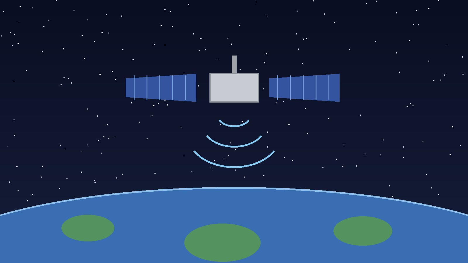
- GPS stands for Global Positioning System. It is a space-based radio navigation system owned by the United States government. A GPS receiver listens for signals from satellites in orbit, measures how long those signals took to reach it, and uses that timing information to calculate its latitude, longitude, and altitude. In everyday terms, GPS is the system that tells a device where it is. The maps app on a phone is not GPS itself. It is software that displays a GPS position, usually on a map, often combined with other location information.
Introduction
Type “what does the gps stand for” into a search box and you will get a short answer in seconds. The letters are easy to expand. What is harder to grasp, and far more interesting, is what sits behind those three letters: a network of satellites, a set of ground stations, and a receiver in your pocket that together can work out where you are on Earth, often within a few meters.
GPS began as a military project. It is now part of everyday life in ways most people barely notice. It guides drivers to an unfamiliar address, helps a hiker check a position on a trail, and supports farmers steering equipment across a field. It also keeps time with extraordinary precision, which matters for systems far beyond navigation.
This article answers the question directly, then explains the system in plain English: what GPS stands for, where the name NAVSTAR comes from, how a receiver turns faint radio signals into a location, what the constellation looks like, how GPS relates to other satellite navigation systems, and where it works well or struggles. No technical background is needed.
What the Letters Stand For, and What People Often Get Wrong
GPS stands for Global Positioning System. Each word in that expansion carries meaning, and each one is worth a moment of attention.
Global means the system is designed to work anywhere on Earth, not only in one country or region. A receiver does not need to be near a particular tower or station to get a position, as long as it can receive signals from enough satellites in the sky above it. Positioning means the core job of the system: working out a position, expressed as latitude, longitude, and altitude. System is a reminder that GPS is not a single satellite, a single app, or a single device. It is a whole system with parts in space, parts on the ground, and parts in the hands of users.
Two common mistakes are worth clearing up at the start. First, GPS does not stand for “global positioning satellite,” although that phrase is widely used in conversation. The S stands for System, because a single satellite cannot locate you on its own. Second, GPS is not the same thing as a maps app. A maps app draws roads and plans routes. GPS supplies the raw position that the app then places on the map.
The original name of the American system was NAVSTAR GPS, where NAVSTAR stands for Navigation System with Timing and Ranging. That name points to the two things the system was built to deliver: navigation and precise timing. Timing may sound secondary, but it is the heart of how GPS works. Today, most people simply say GPS, and NAVSTAR survives mainly as a historical name.
A Short History of GPS: From Military Project to Everyday Tool
The story of GPS begins in the space age. NASA notes that GPS has its origins in the Sputnik era, when scientists tracked a satellite by shifts in its radio signal, known as the Doppler effect. If a moving satellite sends a steady signal, the frequency received on the ground shifts as the satellite approaches and then moves away. Early researchers realized that principle could be turned around: if you know where a satellite is and can measure its signal carefully, you can work out where you are.
In the early 1970s, the United States Department of Defense wanted a robust satellite navigation system for military use. Earlier aids had limits: some worked only in certain areas, some were less accurate than planners needed, and some could be disrupted. A satellite system promised global coverage and consistent accuracy. The Department of Defense therefore began the NAVSTAR project in 1973, and the first NAVSTAR satellite was launched in 1978, according to NASA.
Building a full constellation took years. Satellites were launched in stages through the 1980s and into the 1990s, and the system gradually became usable over more and more of the planet. NASA records that the 24 satellite system became fully operational in 1993. That was Initial Operational Capability, declared 8 December 1993; formal Full Operational Capability followed in April 1995. The difference is a matter of how “fully operational” is defined and dated, not a disagreement about the basic sequence: a 24 satellite core constellation, built up over roughly two decades, delivering global service.
Civilian access has its own turning point. In 1983, Korean Air Lines Flight 007 strayed into Soviet airspace and was shot down. The United States Department of Defense account notes that President Ronald Reagan then made the system available to the world. Civilian service was deliberately less accurate at first: a feature called Selective Availability degraded the civilian signal to about 100 meters. Britannica notes that Selective Availability was terminated in 2000, in part because of safety concerns as civilian ships and aircraft came to rely on GPS. Ordinary civilian accuracy then improved sharply, to about 10 meters in typical conditions.
The Gulf War of 1990 to 1991 gave GPS its first large scale public test in combat, according to the United States Department of Defense. Handheld military receivers of that era were bulky, with early models weighing about 35 pounds. The contrast with today is striking: a GPS chip now fits inside a watch or a phone.
Ownership has remained with the United States government throughout. GPS is available free of charge to anyone in the world with a GPS receiver. The United States Space Force now develops, maintains and operates the space and control segments, a role previously held by the United States Air Force. No subscription is needed to receive the open civilian signals.
How GPS Works in Plain English
GPS works by timing. That single idea explains almost everything else about the system, so it is worth slowing down for it.
Each GPS satellite carries atomic clocks and broadcasts its position and the time the signal left the satellite. Because radio signals travel at the speed of light, a tiny difference in arrival time corresponds to a large difference in distance. By measuring travel time from several satellites and multiplying by the speed of the radio wave, the receiver can calculate its distance from each satellite.
One distance alone is not enough. Knowing you are, say, 20,200 kilometers from one satellite puts you somewhere on the surface of an imaginary sphere centered on that satellite, but it does not say where on that sphere you are. Add a second satellite, and the two spheres intersect in a circle, narrowing the possibilities. Add a third, and the circle narrows to two points. Add a fourth, and the receiver can settle on a single point in three dimensions: latitude, longitude, and altitude.
That is why guides to GPS so often repeat the number four. In theory, three satellites can give a three dimensional position, but in practice a receiver needs at least four. The reason is the receiver’s own clock. Satellite clocks are atomic clocks, kept to extraordinary precision. The clock in an ordinary phone or car receiver is far less precise, and even a tiny clock error would translate into a large position error. By using a fourth satellite, the receiver can solve for the clock error as well as for its position, correcting its own timing against the satellite clocks. Britannica explains this point directly: at least four satellites are used in practice to offset inaccuracy in the receiver’s clock.
A helpful picture comes from NOAA, which compares each satellite signal to a giant tape measure stretched between the satellite and your receiver. The receiver reads several tape measures at once and works out the one place on Earth that fits all of those distances. The calculation repeats continuously, so a moving receiver can update its position and work out its speed and direction.
A basic GPS receiver only listens. It does not transmit anything back to the satellites, and it does not need a mobile phone signal or an internet connection to calculate a position. That is why a handheld GPS unit can work far from cell towers, on a mountain or at sea, as long as it has a clear view of the sky. A phone often combines GPS with Wi-Fi networks and cell towers for a faster first position, but the satellite calculation itself is independent of those aids.
The Three Parts of the System
GPS is conventionally described as having three segments, or parts. Understanding the three parts makes the whole system easier to picture, and explains why a problem in any one part can affect users everywhere.
The space segment is the constellation itself. NASA describes at least 24 United States government satellites in six orbital planes, in medium Earth orbit at about 20,200 kilometers, or about 12,550 miles, above the Earth, circling the planet every 12 hours. In practice, more than 30 GPS satellites are operational at any given time, because spares and newer satellites are kept in orbit alongside the core 24. NOAA similarly notes that over 30 satellites are arranged so that users can view at least four from virtually any point on the planet.
The control segment is the network of ground stations that keeps the constellation healthy and accurate. Ground stations track the satellites, measure their orbits, monitor their clocks, and upload corrections. Without this housekeeping, satellite positions and clocks would drift, and user positions would drift with them. NOAA puts it simply: ground stations monitor and control the satellites and help determine their locations, both where they were and where they are forecast to be.
The user segment is everything that receives and uses the signals: phones, car navigation units, handheld hiking units, watches, aircraft and ship systems, farm equipment, survey instruments, and scientific receivers. A device needs only an antenna, a receiver chip, and software to do the timing calculation. The variety here, from a fitness watch to many high-tech receivers that can figure out a position to within a fraction of an inch according to NOAA, explains why GPS feels so different in different contexts even though the satellites are the same.
These three parts must work together. A satellite with a faulty clock, a ground station that misses an orbit correction, or a receiver with a blocked view of the sky can each degrade a position. With more than 30 satellites in orbit, a receiver can usually choose a healthy set of four or more and discard a suspect signal.
The Satellite Constellation and the Signals
The constellation is designed around a simple requirement: no matter where you stand on Earth, at least four satellites should be visible above the horizon. That led to the six plane design described by NASA: six orbital planes, inclined at 55 degrees from the equator, each carrying several satellites, spreading coverage around the globe.
Altitude is part of the same design. At about 20,200 kilometers, GPS satellites sit in medium Earth orbit, far above the International Space Station and far below geostationary satellites. That height gives each satellite a wide view of the Earth, so fewer satellites are needed for global coverage than would be needed in low orbit. Each satellite completes an orbit in about 12 hours, which is why the pattern of visible satellites changes steadily through the day.
GPS signals are radio signals, broadcast on specific frequencies. Britannica notes that each satellite broadcasts on two frequencies: L1, 1575.42 megahertz (military/civilian), and L2, 1227.6 megahertz (military). The civilian coarse acquisition code, often shortened to C/A code, is the open signal ordinary receivers use. The military precision code is restricted. Modernized satellites add further civilian signals, which help newer receivers get faster and more accurate positions.
Two levels of service follow from this structure. NASA explains that GPS provides a Standard Positioning Service, available to all users worldwide, free of any direct user charges, and a Precise Positioning Service, restricted to United States armed forces, federal agencies, and selected allied armed forces and governments. For almost every reader, the Standard Positioning Service is the relevant one.
One detail surprises many people: GPS satellites broadcast, but they do not know where you are. They send out their position and time to anyone listening. All position calculation happens inside your receiver. The satellites never receive your location back, and the basic GPS service does not track you. If an app shares your location, that sharing is done by the app over a separate connection, not by GPS itself.
Other GNSS Systems: GPS Is Not the Only One
GPS was the first fully global satellite navigation system, but it is no longer the only one. The general term for this family is GNSS, which stands for Global Navigation Satellite System. GPS is one GNSS. Modern phones often listen to several systems at once, which improves availability and accuracy, especially on city streets lined with tall buildings.
Russia maintains GLONASS, which Britannica lists alongside GPS as a maintained constellation. The European Union operates Galileo, which Britannica notes began operations in 2016 after financing was approved in 2007 for 30 satellites. China operates BeiDou, which Britannica traces from early local satellites launched in 2000 and 2003 to a third generation constellation of 30 satellites completed in 2020 that provides global service.
For the ordinary user, the practical difference is small. A phone using GPS plus Galileo plus GLONASS plus BeiDou will usually find a position faster and hold it better in a partial sky view than a phone using GPS alone, because it has more satellites to choose from. The answer is the same kind of result: latitude, longitude, altitude, and time.
This is also why “GPS” is often used loosely to mean satellite positioning in general. Strictly speaking, a phone using Galileo satellites is using GNSS, not GPS. In everyday speech, people say GPS for the whole experience. For accuracy, keep the distinction: GPS is the American system, GNSS is the family, and a modern device commonly uses several systems together.
Common Uses of GPS
Driving directions are the use most people think of first, but they are only a fraction of what GPS does. A tour through the main uses shows how deeply the system is woven into modern life.
In transport, GPS guides cars, trucks, aircraft, and ships. Commercial jetliners and private airplanes use GPS signals, as do ambulance fleets, family automobiles, railroad locomotives, farm tractors, and ocean liners, according to Britannica. Aviation and maritime users value GPS because it works over oceans and remote land where ground based aids are sparse.
In outdoor recreation and fieldwork, handheld receivers and GPS watches help hikers, runners, cyclists, sailors, and golfers record routes and find their way back. Surveyors and construction teams use GPS for precise positioning and mapping, and farmers use GPS guided equipment to plant, spray, and harvest in straight, repeatable lines.
In science, GPS supports geodesy, the study of the shape of the Earth and its gravity field, and helps monitor sea level, ice melt, and movements of the Earth’s surface. NOAA’s continuously operating reference stations track tiny movements of the Earth’s surface in the United States, turning GPS from a navigation tool into an Earth measurement instrument.
In everyday devices, GPS quietly supports functions that do not look like navigation at all. Emergency calls can include a location to help responders find a caller. Photo apps can tag where a picture was taken. Fitness apps can measure a run. Beneath all of this, GPS time synchronization keeps mobile networks, power grids, and financial systems aligned to a common, precise time reference.
Accuracy and Limitations: How Precise Is GPS, and When Does It Struggle?
For an ordinary phone outdoors with a clear view of the sky, GPS is typically accurate to within about 10 meters, or about 33 feet, according to Britannica’s account of the basic civilian service. NASA gives a similar picture, with about 10 meters horizontally and 20 meters vertically at the 95 percent level under performance standards, while noting that actual performance can be much better and that the average user range error has been demonstrated at one meter or better in recent years. NOAA adds that many high tech receivers can figure out a position to within a fraction of an inch, which refers to specialized survey receivers, not to an ordinary phone.
Several factors explain why accuracy varies. The first is satellite geometry: satellites spread widely across the sky give a better fix than satellites bunched together. The second is signal delay in the atmosphere, as signals pass through the ionosphere and the troposphere and are slowed slightly. The third is multipath, where signals bounce off buildings or cliffs before reaching the receiver, arriving slightly late. The fourth is simple blockage: GPS signals are weak by the time they reach Earth, and they do not pass through solid objects well.
That last point explains the most common frustrations. GPS works poorly indoors, underground, in parking garages, and between tall buildings. It can also struggle under dense tree cover and in narrow valleys. In those situations, a phone usually falls back on Wi-Fi or cell tower positioning, which is why a blue dot can jump or drift on a city map even though GPS itself is healthy.
GPS gives position, not context. It cannot tell you that a road is closed, that a bridge has a weight limit, or that a footpath is flooded. That information comes from map data, which can be out of date. A route that looks efficient on a screen may cross private land or terrain beyond a walker’s ability, so checking a route against a proper map and local conditions still matters, especially outdoors.
Interference and spoofing are rarer concerns, mainly for professional and military users. Jamming overwhelms GPS signals with noise, while spoofing sends false signals designed to mislead a receiver about its position or time. Civilian receivers are more vulnerable than military receivers, which use encrypted signals. This is one reason critical systems do not rely on GPS alone.
Battery use is a practical limitation too. Keeping a GPS receiver active, alongside a screen and a data connection for maps, drains a phone battery faster than many other tasks, which is why dedicated handheld units remain popular for multi day hikes.
GPS vs GNSS vs Maps Apps: Clearing Up the Confusion
Three terms cause most of the confusion around this topic, so it helps to place them side by side.
GPS is the American satellite navigation system, owned by the United States government, built around the NAVSTAR constellation. When someone says “my GPS says I am here,” they usually mean a device using the American system, possibly together with other systems, to calculate a position.
GNSS is the umbrella term. It stands for Global Navigation Satellite System, and it covers GPS plus GLONASS, Galileo, BeiDou, and any other global system. A device described as GNSS capable can listen to more than one constellation. A device described only as GPS may in practice still listen to others, because manufacturers often use the familiar term loosely.
A maps app is software. It takes a position, from GPS or GNSS, from Wi-Fi, or from cell towers, and shows it on a map, plans a route, estimates arrival time from traffic data, and gives turn by turn instructions. Without a position source, a maps app can still display maps and plan a route between two typed addresses, but it cannot show where you are right now. Without a maps app, a GPS receiver can still give latitude and longitude, but most users would find raw coordinates hard to use alone.
A similar distinction applies to location services on a phone. That setting controls whether apps may use position information at all. Turning it off stops apps receiving a position, but it does not switch off the satellites, and it does not erase a position already recorded. Turning it on does not mean GPS is active at every moment; the phone uses GPS when an app requests a precise position and conditions allow.
Frequently Asked Questions
What does GPS stand for?
GPS stands for Global Positioning System. It is a space-based radio navigation system owned by the United States government that lets a receiver calculate its latitude, longitude, and altitude from satellite signals.
What does NAVSTAR stand for?
NAVSTAR stands for Navigation System with Timing and Ranging. It was the original name of the American GPS program, launched as a Department of Defense project in 1973, with the first satellite launched in 1978. Today, most people say GPS, and NAVSTAR is mainly a historical name.
How does GPS work in simple terms?
Each GPS satellite broadcasts its position and a precise time from its atomic clocks. A receiver measures how long the signals took to arrive from at least four satellites, multiplies those times by the speed of the radio waves to get distances, and finds the single point that fits all of those distances. That point is the receiver’s position.
Why does GPS need four satellites?
Three satellites can narrow a position to two possible points in theory, but a fourth is needed in practice to correct for the receiver’s own clock error. Ordinary receiver clocks are far less accurate than satellite atomic clocks, and the fourth measurement lets the receiver solve for that error as well as for its position.
Is GPS free to use?
Yes, for ordinary users. The Standard Positioning Service is available worldwide, free of any direct user charges, to anyone with a GPS receiver, according to NASA. You pay for the device and possibly for map data or a data connection, but not for the GPS signals themselves.
Does GPS need the internet or a phone signal?
No, not for the basic position calculation. A GPS receiver only listens to satellite signals, and it can calculate a position without a mobile signal or an internet connection. Phones often combine GPS with Wi-Fi and cell tower data to get a faster first fix, and maps apps need data to download maps and traffic information, but the satellite fix itself does not need a network.
Does GPS work indoors?
Usually poorly, or not at all. GPS signals are weak and do not pass through roofs, walls, and other solid structures well. Indoors, phones normally rely on Wi-Fi positioning, Bluetooth beacons, or cell tower estimates instead, which is why an indoor blue dot is less precise than an outdoor one.
What is the difference between GPS and GNSS?
GPS is the American system. GNSS, short for Global Navigation Satellite System, is the general term covering GPS and other systems such as Russia’s GLONASS, the European Union’s Galileo, and China’s BeiDou. Many modern devices use several GNSS constellations together.
How accurate is GPS on a phone?
Typically within about 10 meters, or about 33 feet, outdoors with a clear sky view, based on Britannica’s account of the basic civilian service. Actual accuracy varies with satellite geometry, atmospheric conditions, reflections from buildings, and the quality of the receiver. Specialized survey receivers using corrections can be far more accurate, but that level of precision is not typical for a phone.
Who owns and operates GPS?
GPS is owned by the United States government. The United States Space Force now develops, maintains and operates the space and control segments, a role previously held by the United States Air Force; ownership has not changed. The civilian service remains open to users worldwide.
Can GPS track me?
GPS itself does not track you, because a basic receiver only listens and calculates its position locally. Satellites do not receive your location back. However, an app can record and share a position obtained from GPS over a separate connection. Privacy therefore depends on app permissions and device settings, not on the satellites alone.
When did GPS become available to civilians?
The Department of Defense began the NAVSTAR project in 1973 for military use. President Ronald Reagan made GPS available for civilian use following the shooting down of Korean Air Lines Flight 007 in 1983. Civilian accuracy was deliberately limited by Selective Availability until that feature was terminated in 2000, after which ordinary civilian accuracy improved markedly.
Keep reading: How Many Satellites Are in Orbit? The Active Count, the Total in Space, and Why Sources Disagree
Sources & references
- National Oceanic and Atmospheric Administration, National Ocean Service, "What is GPS?" (opened and read 29 October 2026). Expansion of GPS, three part system, satellite altitude of approximately 20,200 kilometers, over 30 satellites, at least four visible from virtually any point, position often within a few yards, specialized receivers to a fraction of an inch.
- National Aeronautics and Space Administration, "GPS" (opened and read 29 October 2026). Three segments, at least 24 satellites in six orbital planes at about 20,200 kilometers circling Earth every 12 hours, over 30 operational satellites, Sputnik and Doppler origins, NAVSTAR first satellite 1978, 24 satellite system fully operational in 1993, Standard and Precise Positioning Services, free worldwide civilian service, accuracy discussion.
- Encyclopaedia Britannica, "GPS" (opened and read 29 October 2026). Expansion of GPS, four or more satellites, latitude, longitude, and altitude, Department of Defense military origins, civilian service within 10 meters, GLONASS, Galileo, and BeiDou, triangulation explanation, fourth satellite clock correction, signal frequencies, Selective Availability until 2000.
- United States Department of Defense, "What on Earth is the Global Positioning System?" (opened and read 29 October 2026). Expansion of GPS, 1973 military project, civilian availability after the Korean airliner incident, government ownership, free worldwide use, Gulf War first combat use, early handheld weight, Standard and Precise Positioning Services, GLONASS and BeiDou mentions.


